 (+971) 8007 4267
 (+91) 946 340 7140
 (+1) 628 432 4305

In a world where exploration and adventure know no bounds, the demand for sophisticated navigation apps has skyrocketed. Boaters, sailors, fishermen, and outdoor enthusiasts all seek a reliable companion to guide them through the vast waters and uncharted territories. If you’ve ever wondered about the intricacies of creating a navigation app akin to the renowned Navionics, you’ve landed in the right place.
Embarking on the journey to develop your navigation app is no small feat. From conceptualization to implementation, every step requires careful consideration. Join us on this deep dive into the development process, uncovering the key features that set Navionics apart, estimating the costs involved, and navigating through the complexities of bringing your vision to life.
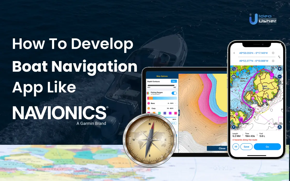
What is the Navionics App?
The Navionics app is a boat navigation app available for iOS and Android devices. It provides detailed marine charts, navigation features, and other tools to assist boaters and fishermen.
Boasting compatibility with Apple iOS 13.0 or higher and Android OS 7.0 or higher, the Navionics Boating app ensures that users can harness its full potential on their up-to-date devices.
At its core, the Navionics Boating app transforms ordinary devices into sophisticated chart plotters, offering detailed insights into freshwater lakes and saltwater expanses around the globe. Users can explore depths, identify buoys, navigate channels, and steer clear of obstructions, all at their fingertips. The app serves as a virtual compass for mariners, providing essential charting details for a safe and enjoyable boating experience.
The app’s accessibility begins with a limited free trial, allowing users to download the application from their preferred app store—Navionics Boating. During this trial period, individuals can revel in the full spectrum of chart details and app features. However, once the trial concludes, users have the option to purchase specific regions of coverage based on their navigational needs. The flexibility to tailor the app to one’s preferred geographic areas ensures a customized experience for sailors, anglers, and water enthusiasts.
Key Market Takeaways
In the ever-expanding global navigation app market, which reached a valuation of USD 911.6 million in 2020 and expected to grow at steady pace till 2028, businesses in the boat navigation sector find themselves at a crucial juncture.
According to MillionInsights, the market is anticipated to grow at a compound annual growth rate (CAGR) of 10.8% from 2021 to 2028, presenting substantial opportunities for those seeking to establish a foothold in this dynamic industry. The demand for analyzing navigational marks on both land and sea, particularly in developed economies like the U.S. and Germany, is a driving force behind this growth.
Understanding regional nuances is pivotal for businesses looking to capitalize on the burgeoning market. In the U.S., there is a pronounced demand for GPS navigation and maps systems, creating a ripe environment for innovation. Similarly, the European Union witnesses an increasing appetite for advanced navigation solutions, while in India, opportunities emerge with the growing adoption of portable navigation devices. However, challenges persist, with positional errors hindering accurate geographical landscape identification.

Source: MillionInsights
Despite these challenges, the market is evolving positively, with key players focusing on community-based traffic and navigation solutions. Investments from innovative apps, such as Savvy Navvy, introduce routing algorithms that analyze wind and tide impacts, presenting new avenues for differentiation. Additionally, safety features like speed camera warnings for transport drivers and the growing demand for dynamic lane guidance contribute to market expansion.
For businesses venturing into boat navigation app development, drawing inspiration from industry leaders becomes paramount. Qualcomm Inc., Hexagon AB, and Garmin Ltd. serve as benchmarks with their successes and innovations. Emulating their strategies and incorporating user-centric functionalities can guide businesses towards creating a distinctive navigation app.
How Does a Boat Navigation App like Navionics App Work?
The Navionics app has gained popularity among boating and angling enthusiasts for its comprehensive set of features designed to enhance on-water experiences. Here’s how the Navionics app works,
1. Maps: Foundation for Exploration
Upon initial download, users are provided with a base map, offering a basic overview of the water landscape. However, to access detailed information, users need to download specific chart data. This ensures a more comprehensive understanding of the aquatic terrain.
2. Layers and Overlays: Customizing Information
Then it allows users to tailor their experience through chart layers and overlays. This customization feature enables individuals to focus on specific information relevant to their boating or angling needs, whether it’s navigation, fishing locations, or underwater topography.
3. Planning Tools: Strategic Navigation Assistance
The app offers planning tools that facilitate efficient trip preparation. Users can search by Lat/Long, save markers for future reference, and measure distances on the map, providing a user-friendly platform for strategic voyage planning.
4. Weather: Informed Decision-Making
Considering the significance of weather conditions in maritime activities, the app also provides users with forecasts and other weather-related information. This feature enables boaters to make informed decisions before embarking on a journey, prioritizing safety and awareness.
5. Route: Navigational Flexibility
Creating and following routes is a prominent feature of the app. Users can choose between automatic and manual options, allowing for flexibility in navigation. Whether following suggested routes or crafting custom paths, the boat navigation app can accommodate both preferences.
6. Connections: Social and Safety Aspect
Recognizing the social nature of boating, the app facilitates connections between users. Through features such as profile sharing, live location updates, tracks, routes, and markers, individuals can stay connected with friends and fellow boaters, adding a layer of safety and coordination to their maritime experiences.
Why Boat Navigation Apps are in Trend Recently?
Boat navigation apps have revolutionized the maritime industry, offering a myriad of advantages for businesses and boaters alike. Here are ten key benefits that contribute to the growth and efficiency of businesses in the navigation industry:
1. Enhanced Navigational Capabilities
Enhancing navigational capabilities through the adoption of boat navigation apps has become pivotal for the growth of navigation businesses. These apps, equipped with features such as NOAA raster charts and vector charts, serve as indispensable tools in empowering users with advanced functionalities for precise route planning, real-time tracking, and heightened situational awareness on the water.
Navigation businesses strategically leverage custom boat navigation apps to gain a competitive advantage. By tailoring features to meet specific industry needs, these businesses elevate user experiences and ensure seamless integration with other maritime technologies. The implementation of such apps not only provides a distinct edge in the market but also contributes to the overall growth of the business.
2. Seamless Connectivity
By incorporating seamless connectivity features, boat navigation businesses can significantly boost their growth by developing and offering their own dedicated boat navigation app. This specialized application plays a pivotal role in fostering enhanced communication among boaters, thereby creating a unique and valuable platform for the maritime community. Through real-time sharing of travel status and current locations, the app not only promotes a sense of community but also facilitates collaborative efforts on the water.
Boaters using the navigation app can effortlessly stay connected with each other, sharing vital information about preferred routes, potential hazards, and noteworthy points of interest. This heightened level of communication not only improves overall safety by facilitating effective information exchange but also contributes to a more enjoyable and social boating experience for users.
3. Expert Guidance for Optimal Routes
Developing and implementing a proprietary boat navigation app can be quite lucrative for navigation businesses. These applications set themselves apart by delivering expert guidance for optimal routes, thereby elevating users’ overall navigation experiences. The key to this differentiation lies in the integration of advanced algorithms and real-time data analysis, enabling the app to assess crucial factors like weather conditions, water depth, and potential obstacles.
By leveraging such cutting-edge technology, businesses can offer boaters a tool that not only minimizes travel time but also enhances safety on the water. This expert guidance becomes a crucial feature that distinguishes the navigation app in a competitive market. As boaters increasingly seek reliable and efficient navigation solutions, having a proprietary app with intelligent route planning capabilities becomes a strategic move for businesses to stay ahead.
4. Offline Usage for Uninterrupted Navigation
The incorporation of offline usage capabilities in boat navigation apps is a critical feature that assures uninterrupted navigation, particularly in areas with limited or no network coverage. These applications allow users to download charts and essential navigation data in advance, ensuring that critical information remains accessible even when boating in remote or poorly connected areas. This capability is particularly valuable for maritime businesses and boaters who venture into regions where a stable internet connection may be unreliable.
Navigation businesses leverage this functionality to enhance the versatility and reliability of their apps. By enabling users to download charts and access them offline, these applications cater to the diverse needs of boaters, from offshore enthusiasts to professionals working in remote maritime environments. This feature not only boosts the practical utility of the navigation app but also positions it as a dependable tool in various scenarios, contributing to increased user satisfaction and loyalty.
5. Comprehensive Weather and Tide Information
Developing a proprietary boat navigation app with integrated comprehensive weather and tide information can be a strategic move for navigation businesses. By offering a one-stop solution that goes beyond traditional functionalities, businesses can attract and retain a diverse user base, catering to both recreational and professional boaters. The app’s real-time weather updates and tidal data not only enhance user experience but also contribute to informed decision-making, prioritizing safety and optimal route planning. This added layer of value establishes the navigation business as an indispensable tool for boaters, fostering customer loyalty and expanding the app’s user base over time.
6. Dock-to-Dock Routing
The inclusion of advanced features like dock-to-dock routing in boat navigation apps represents a significant leap in precision and efficiency for course planning for navigation businesses. These functionalities take into account specific vessel parameters, such as draft, to offer tailored and accurate navigation routes. By considering the unique characteristics of each vessel, these apps provide precise guidance from departure at one dock to arrival at another, optimizing the route based on the vessel’s draft and other relevant factors.
Navigation businesses can leverage dock-to-dock routing as a key selling point to attract users who prioritize not only accurate navigation but also efficient planning tailored to their vessel specifications. This feature is particularly valuable for professional mariners, as well as recreational boaters with larger or specialized vessels, enhancing the overall utility of the navigation app.
7. Detailed Information on Marinas and Facilities
Boat navigation apps extend their utility beyond basic navigation by providing users with detailed information on marinas, fuel docks, and other facilities, enriching the overall boating experience. These applications serve as comprehensive guides, offering insights into amenities, services, and relevant details about various maritime facilities along a boater’s route.
Navigation businesses can employ this functionality to elevate user engagement and satisfaction. By incorporating detailed information on marinas and facilities, these apps become indispensable tools for boaters seeking not only efficient navigation but also a holistic understanding of the surroundings. Users can access data such as available services, docking fees, and amenities, enabling them to plan stops effectively and make informed decisions during their journey.
8. Navigation Analytics and History
Navigation apps that provide analytics and history tracking capabilities offer users a valuable tool for reviewing and improving their boating experiences. These features allow boaters to access detailed information about their past routes, speeds, and overall performance. By offering insights into navigation patterns and behaviors, these apps empower users to optimize their strategies, enhance fuel efficiency, and refine their boating skills.
Navigation businesses can utilize this analytics and history tracking as key selling points to attract users who are not only interested in real-time navigation but also in continuous improvement. Boaters can analyze their historical data to identify trends, assess the impact of different routes or speeds on fuel consumption, and make informed decisions for future journeys.
9. Safety Features and Alerts
Navigation apps with safety features, including collision alerts, anchor alarms, and proximity warnings, play a crucial role in enhancing boater safety. These advanced functionalities provide users with timely notifications and increased awareness of potential hazards, contributing to a safer and more secure boating experience.
Navigation businesses leverage safety features as a critical aspect of their app’s value proposition. By incorporating collision alerts, boaters are alerted to potential dangers, helping them navigate waterways more cautiously and avoid accidents. Anchor alarms ensure that boaters are aware of any drift or movement, preventing unintentional displacement and anchoring-related issues. Proximity warnings add an extra layer of safety by notifying users of nearby vessels or obstacles, allowing for quick adjustments to the course.
Must Have Features in a Boat Navigation App
Embarking on the development of a boat navigation app for your business? Ensure its success by incorporating key features that not only enhance the user experience but also address the specific needs of maritime enthusiasts. Here’re some of the must have features, you should include in your boat navigation app,
1. Real-Time GPS Navigation
Prioritizing accuracy is paramount for navigation businesses developing their own boat navigation app. By seamlessly integrating real-time GPS navigation into the application, precise location tracking, comprehensive route planning, and continuous updates will be ensured.
This strategic emphasis on precision will transform the app into an indispensable tool for boaters, fostering trust and distinguishing the business within the competitive navigation app landscape. This forward-looking approach anticipates a future where users benefit from unparalleled navigational assistance, solidifying the app’s position as a leader in the industry.
2. Weather Forecast Integration
Granting users the advantage of real-time weather insights is a strategic move that elevates the boat navigation app’s utility. Through the seamless integration of a weather forecasting feature, the navigation business can offer boaters essential information, including real-time data on wind speed, wave height, and precipitation.
This integration not only enhances user safety but also positions the navigation app as an indispensable tool for planning and executing journeys in diverse weather conditions. This foresighted approach anticipates a future where users can confidently rely on the app to make informed decisions based on up-to-the-minute weather information, establishing the app as a trusted companion for boating enthusiasts.
3. Automatic Routing and Waypoints
The navigation app should be designed to streamline the user experience by introducing automatic routing based on individual preferences. By incorporating parameters such as navigational hazards and water depth, navigation businesses can ensure efficient route planning tailored to each user’s specific needs. Furthermore, users are empowered with the ability to customize their journeys effortlessly through easily set waypoints.
This dual functionality not only enhances overall efficiency in navigation but also provides a high level of customization, making the app an attractive choice for businesses aiming to gain a competitive edge in the market. This forward-looking approach anticipates a future where users can enjoy a seamless and personalized navigation experience, reinforcing the app’s appeal in the competitive landscape.
4. AIS Integration
Navigation businesses can distinguish their boat navigation app by placing safety at the forefront through the integration of AIS (Automatic Identification System) data. This feature provides real-time information on nearby vessels, effectively minimizing collision risks for users. By prioritizing safety, the app positions itself as a reliable and trustworthy companion for boaters.
This strategic emphasis fosters loyalty among users and generates positive word-of-mouth within the maritime community, establishing the app as a go-to choice for those who prioritize safety in their navigational experiences. Looking ahead, this commitment to safety anticipates a future where the app becomes synonymous with secure and responsible boating practices.
5. Offline Maps
Navigation businesses can also address the challenges of boating in remote areas by integrating offline map functionality into the app. This allows users to proactively download maps for specific regions, ensuring seamless navigation even in areas with limited internet connectivity. Catering to the adventurous spirit of boaters, this feature positions the app as the go-to choice for those exploring off-the-grid locations.
By recognizing and mitigating the challenges associated with remote boating, the app becomes an essential companion for users seeking uninterrupted navigation experiences in less accessible and more adventurous terrains. This forward-thinking approach anticipates a future where the app is celebrated for its reliability and adaptability in serving the diverse needs of boaters exploring remote and off-the-beaten-path destinations.
6. Augmented Reality (AR) Navigation
Augmented Reality (AR) Navigation is poised to revolutionize the user experience by seamlessly integrating cutting-edge technology into your boat navigation app. As users gaze upon the water, real-time, overlaid information will dynamically appear on their device’s screen.
Navigational cues, markers, and details about nearby points of interest will be intuitively presented through AR, heightening situational awareness to unprecedented levels. This forward-thinking implementation ensures that users can navigate with enhanced precision, making the entire boating experience more intuitive and engaging. Stay ahead of the curve by embracing the future-present of AR navigation in your app development, offering users an unparalleled and immersive maritime journey.
7. Machine Learning for Predictive Analytics
Businesses should harness the power of machine learning for predictive analytics in your boat navigation app. By employing advanced algorithms, the app can analyze extensive datasets encompassing historical navigation information, weather patterns, and individual user preferences.
This transformative capability enables the app to offer predictive analytics, furnishing users with valuable insights into potential hazards, suggesting optimal routes based on real-time conditions, and recommending secure anchoring spots. What sets this feature apart is its adaptability – as users interact with the app, it learns from their behavior, refining its predictions and delivering personalized recommendations over time.
8. Smart Buoy Integration
Navigation businesses should consider forging a seamless connection between your boat navigation app and smart buoys enhanced with cutting-edge sensors. These sensors meticulously monitor crucial water conditions, including currents, temperature, and water depth. Through the app, users gain instant access to real-time data sourced directly from these smart buoys. This integration empowers boaters with the information needed to make informed decisions about navigation and route planning, optimizing their journeys for safety and efficiency. By incorporating smart buoy integration, your navigation app becomes a reliable companion, ensuring users have the most up-to-date insights for a smooth and secure sailing experience.
9. Voice-Activated Commands
Businesses can revolutionize the user experience by integrating a voice-activated assistant into your boat navigation app, enabling seamless control of navigation features through simple voice commands. This hands-free functionality proves especially invaluable when users need to concentrate on steering the boat or managing other tasks, offering a safer and more convenient interaction with the app. With voice-activated commands, users can effortlessly access and control navigation features, further enhancing the user-friendliness and accessibility of your app, while promoting a safer and more enjoyable boating experience.
10. Automated Collision Avoidance System
Businesses can pioneer a new standard in safety by implementing an automated collision avoidance system within your boat navigation app. Employing advanced sensors like radar and sonar, this system adeptly detects nearby obstacles and vessels in real-time.
The app, equipped with this cutting-edge technology, can instantly issue alerts and recommend course adjustments to preempt potential collisions, significantly enhancing overall safety on the water. By seamlessly integrating this automated collision avoidance system, your app not only prioritizes user safety but also alleviates the cognitive load on boaters, allowing them to navigate with confidence and peace of mind.
Also read, “How to Build an AR GPS App: A Quick Guide”
11. Predictive Maintenance Alerts
Businesses can elevate the reliability of your boat navigation app by incorporating predictive maintenance alerts through advanced sensor integration. These sensors diligently monitor the health of critical boat systems, including the engine and navigation equipment. By providing predictive maintenance alerts, the app takes a proactive stance, notifying users of potential issues before they escalate into serious problems.
This forward-looking feature empowers boaters to take preventative action, preventing breakdowns and ensuring a consistently smooth sailing experience. With these predictive alerts, your app becomes an invaluable tool for maintaining boat systems, fostering user confidence and enhancing the overall reliability of marine journeys.
12. Integration with Smart Wearables
Businesses can also upgrade the user experience by extending the reach of your boat navigation app through seamless integration with smart wearables, including smartwatches and AR glasses. This innovative integration enables boaters to receive crucial notifications, navigation prompts, and vital information directly on their wearable devices.
By offering this streamlined connection, your app enhances accessibility and promotes a more hands-free navigation experience. Boaters can stay informed and engaged without the need to constantly check their smartphones, fostering convenience and ensuring that essential information is readily available at a glance, contributing to a safer and more efficient journey on the water.
How to Develop a Boat Navigation App Like Navionics?
Here’s a stepwise guide on how to develop a boat navigation app,
1. Define Requirements
1.1 Target Audience:
The first step in developing a boat navigation app is to clearly define the target audience. This could include boat enthusiasts, professional sailors, fishermen, or anyone involved in maritime activities. Understanding the needs and preferences of the target audience is crucial for designing user-friendly features that cater to their specific requirements.
1.2 Essential Features:
To create a comprehensive boat navigation app, several essential features must be included. GPS tracking is fundamental for real-time location awareness, while route planning ensures efficient navigation. Weather updates are crucial for maritime safety, providing users with current and forecasted weather conditions. Points of interest can enhance the user experience by highlighting important locations such as marinas, fuel stations, and emergency services.
1.3 Compliance with Regulations:
Developing a boat navigation app involves adhering to maritime regulations and safety standards. It is essential to collaborate with relevant maritime authorities to ensure that the app complies with all legal requirements. This includes incorporating safety features, such as alarms for hazardous weather conditions or proximity to restricted zones. Regular updates should be made to reflect any changes in regulations, guaranteeing the app remains a trustworthy and legally compliant tool for maritime navigation.
2. Platform Selection
2.1 Development Environment:
Selecting the appropriate development environment is pivotal for the efficiency of your app development process. For iOS, use Xcode as the integrated development environment (IDE), while for Android, Android Studio is the preferred choice. These tools offer robust features, debugging capabilities, and performance optimization tools essential for creating a seamless and user-friendly boat navigation app.
2.2 Programming Language:
The choice of programming language is closely tied to the selected platform. For iOS development, Swift is the recommended language due to its modern syntax, performance, and integration with Apple’s ecosystem. On the Android side, Kotlin has become the preferred language for its conciseness, safety features, and compatibility with existing Java code. By aligning your boat navigation app with these languages, you ensure a streamlined development process and take advantage of platform-specific optimizations.
3. Integration of Mapping API
The seamless integration of a robust mapping API is pivotal for the success of your boat navigation app. Selecting a reputable provider such as Google Maps, Mapbox, or OpenStreetMap ensures access to accurate and up-to-date mapping data. Verify that the chosen API is tailored to marine navigation, offering features like nautical charts, depth information, and other relevant details crucial for maritime activities. This integration not only enhances the app’s mapping capabilities but also contributes to a reliable and comprehensive user experience.
4. Implementation of GPS Tracking
Utilizing the device’s GPS sensor is a cornerstone for delivering real-time location information in your boat navigation app. Leverage the GPS capabilities to provide users with accurate and constantly updated data on their vessel’s location. Enhance this functionality by incorporating additional features such as heading, speed, and altitude, offering users a comprehensive overview of their maritime journey. By ensuring precision in GPS tracking, your app becomes an indispensable tool for navigation enthusiasts and professionals alike, contributing to a safer and more informed maritime experience.
Also read, “How to Build an AR GPS App: A Quick Guide”
5. Route Planning Development
Empower users with the ability to plan and save routes by integrating a sophisticated route planning feature into your boat navigation app. Enable functionalities such as waypoint insertion, route optimization, and obstacle avoidance to cater to the diverse needs of maritime enthusiasts. This feature not only enhances user control and customization but also positions your app as a comprehensive tool for efficient and personalized navigation experiences.
6. Points of Interest (POIs) Integration
Enrich the user experience by incorporating a Points of Interest (POIs) feature in your boat navigation app. Provide valuable information about marinas, fuel stations, emergency services, and more. Include details like contact information, services offered, and user reviews to ensure users have access to comprehensive and reliable information. This feature enhances the usability of the app, making it an indispensable companion for both planned and spontaneous maritime activities.
7. Weather Integration
Enhance the safety and planning capabilities of your boat navigation app by seamlessly integrating a weather API. Keep users informed with real-time weather updates, including details such as wind speed, wave height, and forecasts. This feature empowers users to make informed decisions during their maritime journeys, contributing to a safer and more enjoyable experience on the water.
Also read, “Weather Augmented Reality Platform Development”
8. Offline Functionality Implementation
Address the challenges of poor network coverage by implementing robust offline functionality in your boat navigation app. Allow users to download maps and essential data for offline use, ensuring that critical navigation features remain accessible in areas with no network coverage. Implement efficient caching mechanisms to store frequently accessed data, optimizing performance and providing a reliable user experience even in remote or challenging maritime environments. This offline capability enhances the versatility of your app, making it a trustworthy companion for navigation enthusiasts exploring various waters.
9. User Interface (UI) and User Experience (UX) Design
Invest in designing an intuitive and user-friendly interface that caters specifically to maritime users. Prioritize usability and readability, considering the unique challenges of users navigating on the water. Implement clear and accessible navigation elements, minimize clutter, and employ contrasting colors for optimal visibility. A well-crafted UI/UX ensures that users can interact seamlessly with the boat navigation app, enhancing overall satisfaction and usability.
10. Testing
Conduct comprehensive testing to ensure the functionality, usability, and performance of your boat navigation app. Test the app in diverse environments, both online and offline, to identify and address potential issues. Pay close attention to how the app performs in real-world maritime conditions, taking into account factors such as varying network connectivity, GPS accuracy, and responsiveness. Thorough testing guarantees a reliable and stable application that meets the expectations of users in different scenarios.
11. Deployment
Prepare for deployment by publishing your boat navigation app on the respective app stores, such as the Google Play Store and Apple App Store. Ensure that all necessary documentation and information, including compliance details, are provided during the submission process. Following deployment, maintain a proactive approach by regularly updating the app to fix bugs, introduce new features, and improve overall performance. Regular updates demonstrate a commitment to providing users with an evolving and reliable navigation solution, contributing to long-term user satisfaction and engagement.
12. Continuous Improvement
Embrace a culture of continuous improvement for your boat navigation app by actively seeking user feedback and leveraging analytics to identify areas for enhancement. Encourage users to provide insights on their experiences and preferences, and use this feedback to prioritize updates and refinements. Regularly updating the app in response to changing user needs and evolving technology standards ensures that your navigation solution remains relevant, competitive, and continues to meet the expectations of a dynamic user base. This commitment to ongoing improvement solidifies your app as a cutting-edge and user-centric tool in the maritime navigation space.


Tech Stacks to Consider for Developing a Boat Navigation App Like
Let’s discuss some of the important tech stacks you should consider, while developing a boat navigation app,
1. FrontEnd
1.1 Map Interface:
When building a boat navigation app, leveraging a responsive frontend framework like React or Vue.js, coupled with the powerful Mapbox mapping library, is instrumental for creating a flexible and interactive map interface. This combination ensures that businesses can provide users with a seamless experience, allowing them to visualize their location and route efficiently on various devices.
1.2 User Interface (UI):
For navigation businesses, a user-friendly interface is paramount. Employing React or Vue.js, along with styling frameworks like Bootstrap or Tailwind CSS, facilitates the creation of an intuitive UI with large, touch-friendly controls. This ensures that users, even in turbulent conditions, can easily navigate the app, enhancing overall usability and safety during maritime journeys.
1.3 Real-Time Data Display:
Businesses in the navigation sector benefit from real-time data updates, and integrating technologies like WebSocket or server-sent events (SSE) with backend solutions such as Node.js or Django is crucial. This allows for the seamless display of real-time information like speed and heading, providing users with accurate and up-to-date insights for making informed navigation decisions.
1.4 AR Navigation Features:
Augmented Reality (AR) features can revolutionize boat navigation apps. Using ARKit for iOS or ARCore for Android, combined with Unity or A-Frame, allows businesses to enhance user experiences by overlaying navigation information onto the live camera feed. This innovative approach improves situational awareness and guides users effectively along their route.
1.5 Offline Mode:
Navigation businesses understand the importance of uninterrupted functionality, even in areas with poor connectivity. By incorporating service workers, IndexedDB, and backend solutions like Firebase or AWS Amplify, businesses can ensure a seamless offline mode. This capability enables users to access essential navigation features without an internet connection, catering to the challenges of maritime environments.
1.6 Weather Information:
Integrating real-time weather information is vital for maritime safety. Utilizing a backend powered by Node.js or Django, along with weather APIs such as OpenWeatherMap or Weatherbit, enables businesses to provide users with accurate weather updates and forecasts. Front-end frameworks like React or Vue.js, coupled with charting libraries like Chart.js, enhance the presentation of weather data, aiding users in making well-informed decisions based on current and forecasted conditions.
2. Backend
2.1 Server Infrastructure:
Establishing a scalable and reliable server infrastructure is vital for navigation businesses developing their boat navigation apps. By leveraging cloud services like AWS, Azure, or Google Cloud, businesses ensure that their backend can seamlessly handle user requests and efficiently manage data storage. This scalability is particularly beneficial during peak usage times or as the user base expands, providing a consistent and responsive experience for maritime users.
2.2 Database Management:
Choosing an appropriate database system, such as MySQL or PostgreSQL, is essential for navigation businesses. This decision ensures efficient storage of user data, waypoints, and routes. Optimizing database queries enhances performance, contributing to a responsive user experience. A well-managed database system is crucial for providing reliable and accurate information to users relying on the navigation app for maritime journeys.
2.3 API Development:
For navigation businesses, creating RESTful APIs is foundational to facilitate seamless communication between the frontend and backend. Secure endpoints for user authentication, data retrieval, and updates enhance the overall reliability and functionality of the boat navigation app. This robust API development ensures a secure and efficient exchange of information, aligning with the needs of maritime users.
2.4 User Authentication:
Implementing a robust user authentication system is crucial for navigation businesses developing boat navigation apps. By incorporating industry-standard protocols such as OAuth, businesses ensure the security of user accounts and data privacy. This feature safeguards sensitive information, fostering trust among maritime users who rely on the app for secure navigation assistance.
2.5 Data Synchronization:
Developing mechanisms for data synchronization across multiple devices is a key consideration for navigation businesses. This ensures that users can seamlessly access their data and settings across various platforms, providing a consistent and user-friendly experience. Effective data synchronization is particularly beneficial for maritime professionals who may switch between devices during their journeys.
2.6 Security Measures:
Prioritizing security measures, including data encryption through SSL/TLS, is imperative for navigation businesses developing boat navigation apps. By regularly auditing and updating security protocols, businesses safeguard user data from unauthorized access or breaches. This commitment to security enhances the app’s reliability and instills confidence among maritime users in the protection of their sensitive information.
2.7 Performance Optimization:
Optimizing server-side processes and implementing caching mechanisms are essential steps for navigation businesses. This ensures that the boat navigation app can handle concurrent requests efficiently, resulting in a smooth and responsive user interface. Performance optimization contributes to a positive user experience, crucial for navigation businesses aiming to provide reliable tools for maritime professionals.
2.8 Scalability:
Designing the backend with scalability in mind is a strategic move for navigation businesses. This enables the infrastructure to scale horizontally, accommodating a growing user base and increasing data loads. Scalability ensures that the boat navigation app can meet the evolving needs of navigation businesses as they expand their services, maintaining high performance levels.
2.9 Backup and Recovery:
Implementing regular backups of critical data is a crucial aspect for navigation businesses developing boat navigation apps. This strategy ensures quick recovery in case of data loss or system failure, minimizing downtime and maintaining data integrity. For maritime users relying on the app for navigation assistance, this backup and recovery capability enhances the overall reliability of the service.
Also read, “How To Develop An App Like Strava? Know The Process”
Top 8 Boat Navigation Apps in USA Like Navionics
Here’re the top 8 boat navigation apps in USA,
1. SailGrib Weather Routing: Sailing with Precision Weather Intelligence

Estimated Annual Revenue: $8 M
SailGrib Weather Routing caters specifically to sailors with a focus on detailed weather forecasts and routing information. This app proves invaluable for those planning extended journeys, where weather conditions play a crucial role in route optimization and overall safety. Sailors can rely on SailGrib to provide them with accurate and up-to-date weather data, aiding in strategic decision-making to avoid adverse weather conditions and ensure a smoother and safer sailing experience.
2. iNavX Marine Navigation: Comprehensive Navigation at Your Fingertips

Estimated Annual Revenue: $5 M
iNavX Marine Navigation is an app for those seeking a comprehensive navigation solution. Its real-time chart plotting and efficient route planning make it a valuable tool for both experienced sailors and casual boaters. The app’s support for a wide array of charts, including NOAA raster and vector charts, ensures flexibility in navigation choices. By incorporating weather overlays, iNavX empowers users with critical information for making informed decisions during their maritime journeys.
3. Garmin ActiveCaptain: Navigating with Garmin Excellence

Estimated Annual Revenue: $8 M
Garmin ActiveCaptain brings the trusted Garmin name to the world of navigation apps, offering an unparalleled level of reliability. Boaters benefit from the seamless integration with Garmin chartplotters, ensuring a cohesive navigation experience. The app provides a suite of features, including marine charts, route planning, and advanced navigation tools, making it a top choice for those who prioritize precision and cutting-edge technology in their boating adventures.
4. SeaNav US: Detailed Charts and Beyond

Estimated Annual Revenue: $4 M
SeaNav US distinguishes itself by offering detailed charts specifically tailored for the United States, including NOAA charts. Beyond standard charting, the app incorporates advanced features such as route planning, AIS tracking for vessel identification, and tidal predictions. Boaters navigating U.S. waters can rely on SeaNav US for a comprehensive and detailed understanding of their surroundings, supported by a range of valuable navigation tools.
5. Aqua Map Marine: Navigation with a Social Twist

Estimated Annual Revenue: $1 M
Aqua Map Marine introduces a social aspect to navigation, combining traditional charting features with the ability to connect with other users. Boaters can enjoy the benefits of detailed charts, efficient route planning, and the unique ability to share routes and waypoints with fellow Aqua Map Marine users. This social integration adds a collaborative dimension to navigation, allowing users to benefit from shared insights and experiences on the water.
6. OpenCPN: Open-Source Power in Your Pocket

Estimated Annual Revenue: $5 M
OpenCPN, known for its desktop use, extends its capabilities to mobile devices as a free and open-source chartplotter and navigation software. Boaters can harness the power of open-source technology in the palm of their hands, accessing a variety of chart formats and navigation features. The app’s availability for mobile use ensures that users can enjoy the flexibility and freedom of open-source navigation wherever their maritime adventures take them.
7. Fugawi Marine 5: Navigate with Precision

Estimated Annual Revenue: $2 M
Fugawi Marine 5 caters to those who seek precision in navigation, supporting both raster and vector charts. Boaters can rely on the app for accurate route planning, weather overlays, and seamless integration with various chart types. Fugawi Marine 5’s commitment to detail and accuracy positions it as a valuable tool for those navigating diverse waters and seeking a comprehensive solution for their boating needs.
8. MarineTraffic: Real-Time Vessel Tracking

Estimated Annual Revenue: $10.7 M
While not a traditional navigation app, MarineTraffic offers a unique perspective by providing real-time vessel tracking. Boaters can use this app to monitor marine traffic, helping them avoid congested areas and make informed decisions about their routes. MarineTraffic’s real-time tracking capability adds an additional layer of situational awareness, contributing to a safer and more informed boating experience.
Conclusion
Boat navigation apps have revolutionized the maritime industry, and creating a bespoke app akin to Navionics is an exciting venture. To embark on this journey, the blog covers key steps, starting with market research and understanding user needs. It delves into crucial features like GPS integration, real-time weather updates, and user-friendly interfaces. The blog emphasizes the importance of precise mapping, route planning, and safety features. Additionally, it explores monetization strategies and the significance of user feedback for continuous improvement.
Are you fascinated by the idea of developing a Boat Navigation App that can rival industry giants like Navionics? Look no further! At IdeaUsher, we specialize in turning your app concept into reality. Our seasoned team of developers, designers, and strategists will guide you through every step of the process, from conceptualization to deployment. Whether it’s mobile or web app development, we’ve got you covered. Your Boat Navigation App dream is just a click away from becoming a successful reality with IdeaUsher!
FAQs
Q1: What are the requirements for a Navionics Boating app?
A1: The Navionics Boating app is a versatile navigation tool available on both iOS and Android platforms. To ensure smooth functionality, it is essential to have a compatible smartphone or tablet. For Apple devices, iOS 10.0 or later is required, while Android devices need to run Android 5.0 or later. Since the app relies heavily on GPS for accurate location tracking, a GPS-enabled device is necessary. Users should also have sufficient storage space on their devices to accommodate the app and downloaded maps. An internet connection is required for initial downloads and periodic updates to charts.
Q2: How do I create a route in the Navionics app?
A2: Creating a route in the Navionics app is a user-friendly process designed for ease of use. Once the app is open, users can navigate to the “Routes” or “Planning” section. From there, they can tap on the starting point on the map and continue to tap waypoints along the desired route. The route can be customized by adding waypoints, including notes, and adjusting it as needed. To finalize the route, users can tap on the endpoint or a designated “Finish” option. The created route can then be saved with a chosen name for future reference.
Q3: Where does Navionics get its data?
A3: Navionics compiles its data from various reliable sources to ensure accuracy and comprehensiveness. This includes information from official hydrographic offices, government agencies, and surveys conducted by Navionics itself. The app also benefits from community edits and contributions made by users, enhancing the richness of its data. Additionally, Navionics incorporates sonar logs from users participating in Navionics SonarChart™ Live, allowing for real-time updates and improvements to navigational data.
Q4: What GPS format does Navionics use?
A4: Navionics utilizes standard GPS coordinates presented in degrees and decimal minutes (DDM) format. This format is widely accepted and employed in marine navigation. For instance, a GPS coordinate may appear as 41° 24.123′ N, 70° 36.789′ W, offering a precise location reference for boaters using the Navionics app.


