


Key Takeaways
- Waze combines GPS signals, driver reports, and real-time traffic data to continuously optimize routes and ETAs.
- Location-based advertising is Waze’s primary revenue model, connecting businesses with drivers based on proximity, route, and destination intent.
- Crowdsourced data strengthens Waze’s navigation accuracy while creating a self-reinforcing network of users, traffic intelligence, and advertising inventory.
- Waze advertising converts navigation activity into measurable local actions, including directions, detours, store visits, and offline sales.
- Waze-like platform development can cost $40,000 to $1M+, depending on real-time infrastructure, AI, crowdsourcing, integrations, and geographic scale.
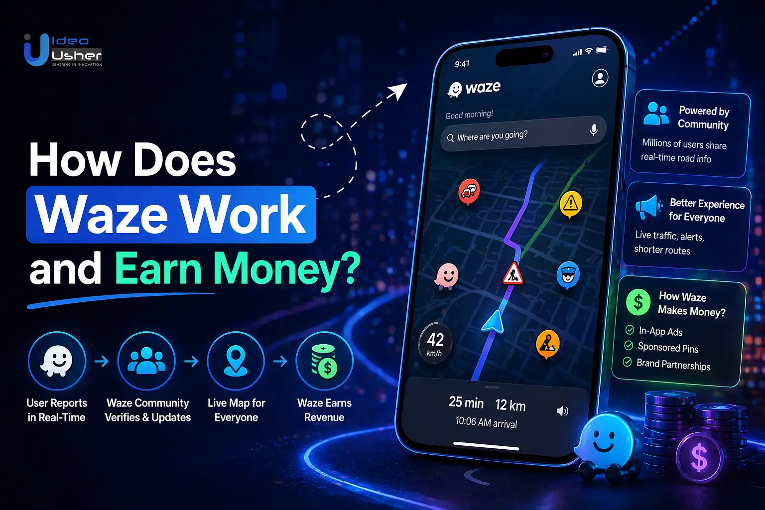
Static maps can tell drivers where roads are, but it cannot fully capture what is happening on them in real time . This gap explains how Waze works and how Waze makes money, as the platform transforms driver interactions, GPS signals and community reports into real-time traffic intelligence while creating valuable location-based advertising opportunities for businesses.
Waze combines GPS navigation, crowdsourced incident reporting, map editing, dynamic route optimization, live traffic data and local business discovery into a connected navigation ecosystem. Its monetization extends beyond navigation through location-based advertising, where businesses can reach drivers based on location and journey context, with its advertising integrated into Google’s broader advertising ecosystem.
In this blog, we will talk about how Waze works, its technology and core features, how Waze makes money, its revenue model, advertising strategy, business economics and what entrepreneurs can learn when building a community-powered navigation platform.
Why the GPS Navigation App Market Is Growing Globally
The global navigation system market was valued at $53.55 billion in 2026 and is projected to reach $77.94 billion by 2030, growing at a 9.84% CAGR. Concurrently, the broader global GPS market is expanding rapidly from $135.39 billion in 2025 toward $273.86 billion by 2030 at a 15.13% CAGR.

This massive growth is fueled by the explosion of on-demand mobility, autonomous logistics, e-commerce delivery fleets, and connected consumer experiences. However, as the market expands, navigation is shifting from a generic consumer utility into a mission-critical, specialized layer of modern enterprise infrastructure.
A. Why Traditional Navigation Apps Leave Room for Innovation
General-purpose platforms like Google Maps dominate universal consumer mapping. Google Maps offers unmatched geographical depth, with more than 250 million businesses and places globally, while more than 2 billion users turn to Google Maps each month. In the U.S., more than 19.5 million American businesses used Google’s tools in 2025 to receive calls, bookings, reviews, and requests for directions.
However, mass-market platforms are designed for broad audiences, leaving room for purpose-built navigation solutions tailored to specialized transportation, commercial fleets, and targeted consumer segments:
- Vehicle-Specific Routing Gaps: Standard routes may not suit heavy trucks, EVs, or two-wheelers, which require clearance limits, axle-weight restrictions, Hazmat rules, battery-aware routing, or road accessibility considerations.
- Hyperlocal & Micro-Mobility Gaps: General maps often miss campus pathways, gated-community roads, informal delivery corridors, and other non-standard transit networks.
- Predictive Fleet Operations: Logistics operators need multi-stop dispatching, driver-shift management, load balancing, and dynamic corridor routing beyond typical consumer navigation capabilities.
B. How Real-Time Location Intelligence Creates a Competitive Edge
Modern GPS platforms build defensibility by pairing raw geospatial mapping with dynamic, real-time location intelligence. Instead of relying solely on baseline road vectors, next-generation platforms fuse live sensor streams, crowdsourced reporting, and machine learning models to optimize routing continuously.

A prime operational benchmark is Waze, rather than duplicating static atlas data, the algorithmic route-ranking engine evaluates complex variables in real time:
- Multi-Factor Route Scoring: Weighs dynamic road classifications, turn penalties, real-time road closures, and user preferences against live crowdsourced incident reports.
- Contextual Monetization & Local Search: Integrates localized business listings and sponsored zero-speed navigational pins that display relevant retail destinations only when vehicles are fully stopped.
- Adaptive ETA Calculations: Employs predictive AI models that dynamically adjust arrival windows based on micro-traffic spikes and sudden road incidents, delivering a responsive navigation experience.
C. Why Enterprises Are Investing in Specialized GPS Platforms
Enterprises across logistics, quick-commerce, field services, ride-hailing, and retail are shifting away from treating GPS as a basic third-party utility. Location intelligence is now recognized as core digital infrastructure that directly dictates unit economics, workforce productivity, and customer lifetime value.
| Industry Vertical | Legacy Consumer Map Usage | Proprietary Enterprise GPS Platform | Strategic Business Impact |
| Last-Mile & Quick Commerce | Generic pin drops leading to main streets. | Sub-meter doorstep geocoding and multi-order dispatch algorithms. | Reduces delivery drop-off times by 15% to 25%, lowering driver wage costs. |
| Commercial Heavy Fleets | Passenger-car routes risking bridge strikes. | Custom truck-attribute routing (weight, height, hazardous materials). | Eliminates compliance fines, vehicle damage, and transit delays. |
| On-Demand Mobility | Third-party per-API-call billing costs. | In-house navigation core with custom surge and driver allocation logic. | Scales trip volume without linear third-party API licensing fees. |
| Field Service & Utilities | Uncoordinated technician dispatches. | Dynamic shift-schedule routing synced to CRM task queues. | Increases billable technician stops per day by 20% to 30%. |
While Google Maps provides the foundational global mapping ecosystem, businesses require proprietary or specialized GPS platforms whenever navigation, route optimization, or driver tracking directly governs their core business model, operating margins, or customer journey.
The Enterprise Takeaway: The GPS market is an expanding ecosystem of specialized spatial solutions, not a winner-take-all consumer battle. Custom GPS platforms combine real-time telemetry, vertical routing, and ERP integration to reduce costs, protect margins, and control critical location data.

What Is GPS Navigation App, Waze?
Waze is a community-driven GPS navigation platform that provides real-time traffic updates, turn-by-turn directions, and road incident alerts. Founded in Israel in 2007 and acquired by Google in 2013 for $1.3 billion, Waze operates as an independent, crowd-sourced co-pilot app. It relies on passive location data and active user reports from tens of millions of drivers globally to recalculate routes dynamically and bypass traffic congestion, construction, hazard zones, and speed traps.
- Crowdsourced Intelligence: The platform’s core operational engine, which relies on drivers actively reporting hazards, accidents, police activity, road closures, and price updates for nearby gas stations.
- Map Editors: A global network of volunteer human editors who maintain, audit, and update the underlying map vectors, street names, turn restrictions, and construction updates.
- Waze for Cities (Connected Citizens Program): A free data-sharing partnership program with local municipal governments, DOTs, and emergency services to exchange real-time traffic data, plan road closures, and improve municipal infrastructure.
- Gamification & Wazer Status: An incentivized point system where drivers earn points, badges, and levels (e.g., Waze Royalty) by logging miles and submitting verified road reports.
- Asymmetric Data Pipeline: Waze actively feeds its real-time incident and police reports into Google Maps, but Waze operates on its own lean routing algorithms and does not ingest Google Maps data.
Platform Overview
Waze combines crowdsourced navigation, real-time traffic intelligence, and location-based advertising into a large-scale mobility platform. The following overview highlights its ownership, reach, supported platforms, monetization approach, and key limitations.
| Category | Platform Information |
| Parent Company | Alphabet Inc. (Google) (Acquired in June 2013 for ~$1.3 Billion). |
| Supported Platforms | iOS, Android, Apple CarPlay, Android Auto, and integrated automotive head units. |
| User Base Scale | ~140 million+ global monthly active users. |
| Monetization Model | Hyper-local contextual ads (e.g., Pin ads, Takeover ads when stopped, Promoted Search) billed to local businesses and brands. |
| Limitations | Lacks offline map downloads, public transit routing, walking directions, or detailed satellite/Street View capabilities. |
Why Waze Depends on Its Driver Community
Unlike traditional navigation systems that rely on scheduled satellite updates and fleet surveying vehicles, Waze’s underlying business and algorithmic viability are entirely dependent on its active user community:
- Sub-Second Temporal Freshness: Millions of active drivers provide unmatched road coverage. Accident and obstruction reports can reach nearby drivers within 30–60 seconds, enabling rerouting before gridlock develops.
- Cost-Efficient Map Maintenance: Community-driven mapping reduces reliance on expensive geospatial fleets. Local editors update turn restrictions, new subdivisions, and temporary detours in near real time.
- Self-Reinforcing Network Effects & Data Moat: Higher user density generates richer spatial velocity data, enabling faster rerouting that attracts more drivers and strengthens Waze’s data advantage.
- Human-Driven Contextual Road Intelligence: Community reports explain why traffic stops, identifying stalled vehicles, flooded underpasses, police checkpoints, and other conditions that automated mapping may miss.
The Enterprise Takeaway: Waze demonstrates that crowdsourced telemetry and gamified human networks can outperform centralized cartography for real-time commuter routing. By converting everyday drivers into live sensors and map editors, Waze maintains one of the freshest, lowest-latency traffic navigation graphs in the world.
How Does Waze Work Behind the Scenes?
Waze operates as a crowdsourced navigation ecosystem that turns millions of connected smartphones into real-time traffic sensors and dynamic reporting nodes. The journey of how waze works from raw GPS signals to an optimized driving route combines edge-device telemetry, community-generated road incidents, distributed stream processing, and dynamic graph-routing algorithms.

Step 1: GPS Captures Driver Location and Movement
Whenever the app runs, the driver’s smartphone continuously polls onboard sensors primarily GPS, GLONASS, cellular triangulation, and inertial sensors (accelerometer and gyroscope).
- Location Coordinates: The app samples latitude and longitude at regular intervals. These coordinates are mapped to Waze’s digital road network using map-matching algorithms to lock the user onto specific street segments.
- Speed & Traversal Time: By calculating the delta between timestamps and geographic points, Waze tracks instantaneous speed and the exact time taken to traverse a specific road segment.
- Direction & Heading: Bearing calculations determine the exact direction of travel, differentiating between opposite lanes on the same road and identifying specific turn trajectories at junctions.
- Movement Patterns (Passive Probing): Waze identifies whether a vehicle is free-flowing, slowing down, stopping at a red light, or crawling in gridlock. This passive telemetry requires no manual input from the driver and serves as the baseline layer for road speeds.
Step 2: Drivers Generate Real-Time Road Signals
Beyond passive telemetry, understanding how Waze works also requires looking at its crowdsourcing model, which relies on active user contributions. Drivers act as on-the-ground informants, generating geotagged road reports with a few taps:
| Road Signal | What Drivers Report |
| Accidents & Collisions | Major or minor crashes that block lanes and reduce road capacity. |
| Traffic Jams | Heavy, standstill, or unexpected congestion affecting traffic flow. |
| Road Closures | Emergency closures, seasonal maintenance, or event-related blocks that make road segments temporarily unroutable. |
| Hazards & Weather Alerts | Road debris, flooding, fog, ice, or stalled vehicles on the shoulder. |
| Police Alerts & Speed Traps | Visible law enforcement activity or speed checks reported to nearby drivers. |
| Construction & Work Zones | Active construction areas, lane reductions, and temporary road restrictions. |
| Potholes & Road Damage | Surface defects and road irregularities that may affect driving conditions. |
| Other Incidents | Missing signage, blocked toll gates, vehicle breakdowns, and other unexpected road issues. |
Waze integrates these community inputs with passive safety alerts, automatic rerouting logic, and instant ETA adjustments across the user network.
Step 3: Waze Processes Live Traffic Data
Raw GPS pings and active user reports flow into Waze’s backend ingestion pipeline, showing how Waze works behind the scenes as data undergoes validation, aggregation, and synthesis:
- Signal Deduplication & Clustering: If dozens of drivers report the same stalled vehicle or slowdown within a small radius, spatial clustering algorithms aggregate them into a single incident entity to avoid duplicate warnings.
- Trust & Reputation Scoring: User reports are weighted based on the reporter’s historical trust score. New reports gain higher confidence as downstream drivers confirm the alert (e.g., giving a “Thumbs Up” or “Still There” response).
- Speed Profile Aggregation: Waze slices each road segment into distinct historical time windows (e.g., 10- to 15-minute historical averages for a Tuesday morning) and continuously overlays real-time speed data.
- Turn & Junction Costs: Traffic delays are rarely uniform across an intersection. Waze measures transition latency separately for left turns, right turns, and straight traversals at each node.
Step 4: The Routing Engine Recalculates the Best Route
Traditional mapping apps traditionally calculate a route once and update it only if a driver strays far off course. Waze continuously optimizes routes in real time using graph theory models (such as modified Dijkstra’s or A* search algorithms):
- Dynamic Segment Weighting: The road network is represented as a digital graph of nodes (intersections) and edges (street segments). Waze dynamically updates the “weight” (travel time cost) of every segment every few seconds based on live traffic speeds.
- Neighborhood Side-Street Routing: If a highway segment’s weight spikes due to an accident, Waze’s algorithm identifies low-weight alternate paths, often routing drivers through residential streets, back roads, or complex turns to bypass bottlenecks.
- Personalized Route Preferences: Waze factors in user trip histories and toggled navigation preferences such as avoiding toll roads, dirt roads, HOV lanes, or difficult left-hand turns across un-signalized intersections.
Step 5: Waze Predicts ETA and Reroutes Drivers
Waze continuously combines historical traffic patterns, live road conditions, and route performance to refine ETAs and adjust routes dynamically. Navigation on Waze is a continuous feedback loop rather than a static, one-time calculation.
- Historical vs. Live Overlays: Waze combines real-time segment speeds with historical speed trends (e.g., How fast does this specific turn lane move on a Friday at 5:30 PM?) to forecast upcoming slowdowns before a driver hits them.
- Proactive Automatic Rerouting: If an emerging incident ahead causes your current path’s calculated travel time to exceed an alternate route by a meaningful threshold, Waze automatically reroutes you mid-drive.
- Continuous ETA Refinement: As traffic density shifts ahead, Waze continuously updates the arrival timestamp minute-by-minute, refining how Waze works to keep ETAs accurate despite unpredictable road conditions.
How Does Waze Make Money?
Waze’s core monetization model is location-based, in-transit advertising, rather than charging drivers a recurring subscription for navigation. By offering a completely free navigation utility, Waze maintains a massive global base of 140M+ monthly active users (MAUs) logging over 36 billion kilometers (22+ billion miles) driven every month across 185+ countries.

The platform monetizes driving intent, physical proximity, and real-time navigation telemetry, showing how Waze works to connect local businesses and enterprise chains with high-intent drivers navigating past physical retail locations.
A. Location-Based Advertising Is Waze’s Core Model
Unlike traditional search or social media ads that capture digital browsing intent, Waze monetizes real-world physical movement. Advertisers pay a premium to reach users based on critical context markers:
- Location & Proximity: Pinpointing drivers who are currently traveling within a specific geographic radius or driving along the exact street where a business operates.
- Route Trajectory: Identifying a driver’s origin and heading to suggest relevant stops (such as coffee shops or gas stations) along their existing commute path.
- Destination Intent: Matching ads to a driver’s final destination, such as offering parking deals or dining options near their destination.
- Local Discovery Behavior: Capturing spontaneous, real-time purchasing decisions while drivers are behind the wheel and ready to act.
B. Promoted Places Put Businesses on Driving Routes
In line with Google’s navigational ad ecosystem, the primary ad format on Waze is Promoted Places (also referred to as Promoted Places in Navigation).
- Visual Experience: Appears as branded, high-contrast icon pins placed along the driver’s 3D navigation map along their active driving route.
- Driver Interaction: When a vehicle approaches an advertised venue, typically within 1,000 feet–1 mile, the pin highlights the business. Tapping it opens hours, promotions, and an “Add Stop” CTA that recalculates directions without disrupting the primary destination.
- Zero-Speed Takeovers: Digital banner overlays appear only when the vehicle is fully stopped at 0 mph for 3+ seconds, such as at red lights, and automatically disappear once movement resumes to support driver safety.
C. How Waze Ads Connect With Google Ads
Waze has shifted from a standalone advertising channel toward integration with Google’s broader advertising ecosystem. In November 2025, Google made Waze inventory available to U.S. advertisers using Performance Max for store goals without separate Waze setup.
Advertisers can reach customers across 6 Google properties and networks: Search, Maps, Waze, YouTube, Gmail, and Google Display Network. Google’s AI automatically optimizes bids, placements, and asset combinations around offline objectives, positioning Waze as inventory within a broader AI-driven local advertising system.
D. How Advertisers Pay for Waze Exposure
Waze inventory is made available to advertisers through Performance Max for store goals campaigns in the U.S., specifically when bidding on local actions alongside store visits or sales goals. Advertisers pay for performance across multiple conversion metrics:
| Performance Metric / Bidding Goal | How It Operates & Monetizes | Typical Pricing / Industry Benchmark |
| Local Actions (Directions & Detours) | Billed when a driver taps to navigate directly to the store, clicks “Add Stop,” or taps to call. | $0.50 – $2.50+ per local action (varies by market & vertical) |
| Cost-Per-Thousand (CPM) / Impressions | Billed based on every 1,000 branded pin or search impressions rendered along active routes. | $1.50 – $3.50 CPM baseline for standard route pins |
| Zero-Speed Takeover Banners | High-impact visual impressions displayed only when the vehicle is at a full stop (0 mph). | $5.00 – $12.00+ CPM (premium brand-awareness tier) |
| Store Visits (Cost-Per-Visit / CPV) | Uses background location telemetry to measure real-world foot traffic lifted by ad exposures. | Included within Performance Max smart bidding thresholds |
| In-Store Sales Attribution | Matches point-of-sale (POS) and CRM purchase data to campaign exposures to quantify offline ROI. | Optimized via value-based bidding (ROAS targeting) |
Why Is Waze’s Advertising Model So Valuable?
Waze’s advertising model bridges the gap between digital ad impressions and physical foot traffic. While conventional digital advertising competes for passive screen time, as how Waze works & captures drivers during moments of physical mobility, intent, and proximity.
1. Waze Reaches Users During Active Trips
Waze captures consumers while they are already traveling, making its advertising environment uniquely suited to real-time decisions, nearby destinations, and immediate retail actions.
This distinction gives advertisers access to consumers at different stages of intent, highlighting why in-transit exposure can create stronger opportunities for immediate engagement than conventional digital placements.
- Digital Browsing Intent (Social/Web): A user scrolling social media or reading an article is in a passive, stationary mindset. The friction to convert from an ad into an immediate physical store visit is high, requiring them to save the offer, leave their current location, and travel to the venue.
- Active Navigation Intent (Waze): A driver navigating on Waze is already behind the wheel, mobilized, and making real-time transit decisions. Advertising to a consumer who is 0.5 to 2 miles away converts ambient travel into immediate retail detour actions.
- High-Attention Moments: Unlike banner ads on web pages with high ad blindness, navigational prompts and zero-speed takeover banners (displayed only when the car stops for 3+ seconds) capture the driver’s direct focus.
2. Location Creates Strong Commercial Intent
Geographic proximity amplifies advertising relevance. On Waze, ad delivery is not determined by general demographics alone but by dynamic spatial-temporal context that connects users with nearby commercial opportunities.
- Dynamic Dayparting & Context: Breakfast promotions trigger between 7:00 AM and 9:30 AM along morning commute corridors; quick-service dining ads surge between 11:30 AM and 1:30 PM; and automotive repair or fuel alerts appear during long highway transit segments.
- Frictionless Detours: When an ad demonstrates that a stop is directly on the user’s route, adding only 1 to 3 minutes of detour time, the psychological barrier to stopping drops significantly compared to discovering a business off-course.
3. Navigation Can Turn an Ad Into a Physical Visit
Waze connects advertising exposure with an actionable journey, helping businesses move consumers from map discovery to navigation and measurable physical visits through a streamlined conversion path.
The conversion process of how Waze works, removes friction at each stage, giving drivers relevant information, simplifying route changes, and helping advertisers connect ad engagement with real-world outcomes.
- Ad Exposure: A branded pin appears directly on the 3D route map, establishing visual brand presence.
- Business Discovery: Tapping the pin or viewing a stopped banner reveals key operational data: fuel prices, current promos, drive-thru availability, and store hours.
- Directions (“Add Stop”): With a single tap, the driver adds the location as an intermediate waypoint along their active journey without resetting their final destination.
- Physical Visit & Conversion: The platform tracks the vehicle’s GPS coordinates to verify physical arrival at the location, giving advertisers closed-loop store visit metrics. (Campaigns frequently drive a 20% to 27%+ lift in verified navigation compared to baseline foot traffic.)
4. Which Businesses Benefit Most From Waze Ads?
Waze advertising is particularly valuable for businesses that depend on local discovery, immediate purchase decisions, and physical visits. Restaurants, fuel stations, retailers, service providers, and other location-based businesses can use contextual ads to influence drivers when proximity and timing matter most.
| Business Category | Why It Thrives on Waze | Key Ad Format & Driving Trigger | Measurable Business Impact |
| Restaurants & QSRs | Capturing morning coffee runs and drive-thru meals. | Promoted Pins & Promoted Search – “Drive-Thru Open — Add Stop (2 min detour)” | Increases off-peak drive-thru traffic by 15% to 25%. |
| Fuel Stations & C-Stores | Diverting drivers needing immediate top-offs and snacks. | Dynamic Price Pins – Displaying live gas prices directly on the map pin. | Drives incremental gallon volume and higher-margin inside-store snacks. |
| EV Charging Networks | Relieving range anxiety with available chargers. | Live Availability Pins – Highlighting fast-charging plug availability and parking perks. | Directs high-value EV drivers to specific charging plazas. |
| Retail & Supermarkets | Capturing evening commute grocery pickups. | “Black Friday Deals — Tap to Navigate” | Converts digital cart orders into physical parking bay pickups. |
| Hotels & Hospitality | Capturing long-distance highway travelers needing rest. | Highway Exit Promoted Pins – “Vacancies Available — Save Location / Navigate” | Fills last-minute unbooked hotel rooms along interstate corridors. |
| Automotive Services | Urgent needs (oil changes, tire repairs, car washes). | Promoted Search & Badges – “Instant Oil Change Ahead — No Appointment Needed” | Captures high-intent emergency service requests on the road. |
| Convenience Stores | Drives high-margin impulse snacking and drink purchases on daily commutes. | “Grab an Iced Coffee — On Your Route” | Increases impulse purchases, nearby visits, and basket value. |
| Local Services | Urgent medical clinics, banks/ATMs, and pharmacies. | Location Arrow Ads guiding drivers just off the main arterial road. | Solves visibility deficits for businesses tucked behind main streets. |
The Enterprise Takeaway: Waze’s advertising model monetizes intent at the point of physical action. By combining real-time location, route optimization, and zero-speed targeting, it turns roadside businesses into navigational destinations.
What Makes Waze’s Business Model Different?
Most ad-supported digital platforms monetize passive visual attention by inserting display banners into a content feed. Waze operates on a fundamentally different economic foundation: it monetizes real-time spatial context powered by a self-sustaining crowdsourced data network.
Rather than paying massive overhead to license static map infrastructure or scrape web data, Waze’s business model turns everyday navigation utility into a decentralized, zero-marginal-cost data generation and advertising machine.
A. Waze Monetizes Context, Not Just Attention
Traditional digital advertising relies on search history, demographics, or browsing behavior to infer user intent while the user is sitting behind a desk or scrolling a smartphone at home. Waze monetizes real-world physical intent and geographic proximity in motion.
| Dimension | Standard Digital Advertising (Social / Search) | Waze In-Transit Advertising |
| User State | Stationary; browsing or reading feeds | Actively mobile; driving behind the wheel |
| Monetization Trigger | Page impressions, video views, search keywords | Physical location, driving vector, upcoming destination |
| Friction to Conversion | High: User must remember offer, stop browsing, and travel to venue later | Low: User is already en route; adding a stop takes a single tap and 1–3 min detour |
| Ad Delivery Timing | Algorithmic feed placement (passive) | High-intent contextual triggers (e.g., zero-speed stops at red lights, on-route pins) |
| Value Delivered | Awareness, digital clicks, e-commerce leads | Instant physical foot traffic and point-of-sale store visits |
By shifting from audience attention to actionable physical context, Waze commands premium local-action ad rates from multi-location brands (such as quick-service restaurants, gas stations, and retail chains) seeking to capture consumers at the exact moment of purchasing capacity.
B. Its Users Generate Part of the Product’s Value
Traditional mapping platforms (like TomTom or early Garmin systems) spend hundreds of millions of dollars maintaining satellite networks, surveying fleets, and licensed GIS datasets. Waze inverted this cost structure by transforming its user base into a decentralized workforce:
- Passive Telemetry as Infrastructure: Every driver with the app open acts as a live GPS probe. Millions of vehicles passively transmit velocity and heading data, allowing Waze to calculate real-time speeds and spot road congestion without deploying physical road sensors.
- Active Community Crowdsourcing: Drivers actively log incident reports such as hazards, road closures, police speed traps, and accidents. This human-in-the-loop layer flags dynamic disruptions hours before municipal road services or traditional map sensors update.
- Volunteer Map Editors (The Long Tail): Over 30,000+ volunteer map editors manually update street layouts, turn restrictions, house numbers, and construction detours via the Waze Map Editor. This crowdsourced maintenance model delivers continuous map accuracy at virtually zero operational marginal cost to the business.
C. Better Navigation Creates More Advertising Inventory
This closed loop links product quality directly to commercial yield: improving route calculation does not just retain users; it directly scales ad inventory and monetization capacity.
Waze’s business model is sustained by a continuous, compounding data-and-revenue flywheel:
- More Drivers: User acquisition expands coverage density across urban corridors and highway segments.
- More Data: Dense vehicle clusters feed raw speed and crowdsourced incident signals into the real-time stream processing engine.
- Better Navigation: Machine learning and graph routing algorithms recalculate the fastest detours, reducing commuter travel times.
- More Engagement: Superior routing drives commuter loyalty and high daily active usage (DAU), keeping the navigation screen active for the entire duration of every commute.
- More Commercial Inventory: Every additional minute a driver navigates creates premium, context-rich ad inventory, generating branded map impressions, zero-speed prompts, and sponsored intermediate stops.
How Much Does It Cost to Build a Waze-Like Platform?
Building a Waze-like platform can range from a focused navigation MVP to a global-scale mobility ecosystem. Development costs depend on real-time infrastructure, geospatial capabilities, crowdsourcing, AI, advertising, integrations, and scalability.
A. Development Cost by Phase
Development costs vary across individual phases, from initial product planning and interface design to real-time infrastructure, AI, crowdsourcing, advertising, security, and production deployment.
| Development Phase | Estimated Cost (MVP → Enterprise) | Key Deliverables |
| Discovery & Planning | 5,000–20,000 | Market research, requirements, user journeys, technical specifications |
| UI/UX Design | 8,000–35,000 | Wireframes, navigation flows, map interface, interactive prototype |
| Core App Development | 30,000–120,000 | GPS tracking, maps, navigation, profiles, destination search |
| Real-Time Backend | 35,000–150,000 | Traffic processing, live location data, routing APIs, WebSockets |
| Crowdsourcing & Community | 15,000–70,000 | Incident reporting, road alerts, validation and user contributions |
| AI & Predictive Intelligence | 25,000–250,000+ | ETA prediction, traffic forecasting, route optimization and anomaly detection |
| Advertising & Business Layer | 15,000–100,000+ | Business profiles, promoted locations, targeting and campaign analytics |
| QA, Security & Launch | 10,000–55,000 | Performance testing, security testing, deployment and monitoring |
| Total Estimated Cost | 40,000–1,000,000+ | Depending on platform scope, AI sophistication, integrations, scalability, and geographic coverage |
Note: These figures are planning ranges rather than fixed quotes. Actual costs depend on product scope, development geography, platform count, and technical architecture. Public estimates also vary substantially because Waze-like products can range from focused navigation MVPs to complex real-time mobility platforms.
B. Platform Cost by Product Level
The required investment increases as navigation capabilities evolve from basic routing into real-time traffic intelligence, predictive analytics, crowdsourcing, AI, multi-region infrastructure, and enterprise-grade mobility services.
| Platform Level | Estimated Development Cost | Typical Scope |
| Basic Navigation MVP | $40,000 – $80,000 | GPS, maps, destination search, basic routing, user accounts |
| Real-Time Navigation Platform | $80,000 – $150,000 | Live traffic, dynamic rerouting, incident reporting, notifications |
| Advanced Waze-Like Platform | $150,000 – $300,000+ | Crowdsourcing, predictive ETA, advanced routing, analytics, business discovery |
| Enterprise Mobility Platform | $300,000 – $500,000+ | Large-scale real-time infrastructure, AI, multi-region deployment, advertising and enterprise integrations |
| Global-Scale Platform | $500,000 – $1M+ | Massive geospatial data pipelines, multi-region infrastructure, advanced ML and high-volume traffic processing |
Note: A basic navigation product should not be confused with a true Waze-scale platform. The latter requires continuous processing of location signals, traffic events, and community reports, alongside infrastructure capable of handling unpredictable peaks in usage.
C. Factors That Affect Waze-Like Development Cost
Beyond core development, several technical and operational factors can significantly influence the final budget, including geographic coverage, data volume, map services, routing complexity, AI requirements, crowdsourcing infrastructure, and advertising capabilities.
- Geographic Coverage: Multi-country expansion requires additional map data, localization, testing, and infrastructure, potentially adding 20,000–100,000+.
- Real-Time Data Volume: High-volume GPS signals, traffic events, and crowdsourced reports require low-latency streaming infrastructure, adding 15,000–75,000+ at scale.
- Map & Location Services: Map rendering, geocoding, places, routing, and traffic APIs can add 5,000–30,000+ in integration costs, plus ongoing usage or licensing fees.
- Routing Sophistication: Advanced routing incorporating traffic, incidents, restrictions, historical patterns, and predicted ETAs can add 20,000–100,000+ in engineering costs.
- Crowdsourced Intelligence: Duplicate detection, report validation, reputation scoring, abuse prevention, and incident expiration can add 15,000–70,000+ in development complexity.
- AI & Machine Learning: Predictive ETAs, traffic forecasting, route personalization, and anomaly detection can add 25,000–250,000+ in development and infrastructure costs.
- Advertising Infrastructure: Promoted locations, business discovery, campaign management, and advertising analytics can require an additional 15,000–100,000+ investment.
How IdeaUsher Can Help Build a Waze-Like Platform
IdeaUsher is an enterprise product engineering partner with 11+ years of software expertise across 50+ countries. Backed by 250+ experts, 1,000+ builds, and a 4.9/5 Clutch rating, we engineer custom community-driven navigation platforms from scratch.
We engineer cloud-native mapping platforms with sub-second GPS ingestion, graph routing, crowdsourced pipelines, and event-driven backends to ensure your navigation platform leads the market.
A. Validate the Navigation and Monetization Model
Rather than competing head-on against generalized global navigation giants, we work with you to engineer focused mapping architectures tailored to high-retention geographic hubs or specialized commercial verticals.
- Targeted Geographic & Vertical Scoping: We focus initial rollouts on dense urban corridors, delivery fleets, trucking routes, and campus ecosystems where localized crowdsourcing creates rapid data network effects.
- Diversified Monetization Architecture: Our software architects design location-based advertising, promoted map pins, branded search, fleet subscriptions, and anonymized municipal traffic-data revenue streams.
- Low-Friction Community Incentives: We build driver points, community leaderboards, and contributor badges that encourage continuous real-time hazard reporting without distracting drivers.
B. Design the Driver and Business Ecosystem
We build synchronized, multi-tier software experiences tailored to serve drivers on the road, local commercial advertisers, and central operations teams.
- Driver Navigation App (iOS, Android & Auto OS): We build battery-optimized mobile and CarPlay/Android Auto interfaces with turn-by-turn voice guidance, one-tap hazard reporting, and real-time lane assistance.
- Local Business Advertising Portal: Our developers create self-service dashboards where retailers, gas stations, and restaurants launch geofenced promotions, manage location pins, and track driver impressions and navigation detours.
- Platform Operations & Community Moderator Console: We engineer centralized dashboards for spam filtering, road-closure management, crowd-report validation, and real-time platform telemetry monitoring.
C. Build Real-Time Location and Routing Infrastructure
We construct ultra-low-latency backend infrastructure capable of ingesting high-frequency GPS pings and recalculating optimal driving paths under massive concurrency.
- High-Throughput Telemetry Ingestion: We deploy Apache Kafka and MQTT event-streaming pipelines to ingest and process continuous GPS telemetry from hundreds of thousands of concurrent drivers with sub-second latency.
- Dynamic Graph Routing & OpenStreetMap Pipelines: Our engineers build OSM-based map engines and graph routing algorithms, such as Contraction Hierarchies, to recalculate optimal multi-point routes as traffic conditions change.
- Geospatial Indexing & Clustering: We integrate PostGIS, Redis GEO, and H3 spatial indexes to cluster proximity-based driver reports, track vehicle groups, and deliver real-time geofenced advertising.
D. Integrate AI and Predictive Navigation
We deploy intelligent machine learning microservices that convert continuous driver telemetry into actionable, predictive navigation decisions.
- Dynamic ETA Prediction: We train gradient-boosting models using travel speeds, time-of-day patterns, weather, and live congestion data to deliver accurate arrival estimates.
- Proactive Traffic Forecasting: Our data engineers build neural network models that detect emerging bottlenecks before severe slowdowns, enabling proactive driver rerouting.
- Automated Incident Classification: We implement NLP and probabilistic validation models to cross-check driver hazard reports, automatically verifying, updating, or removing incident markers.
- Route Optimization & Personalized Recommendations: We build multi-variable route engines that consider tolls, road conditions, vehicle type, live traffic, and personalized driving habits.
E. Launch With a Scalable MVP
We follow an agile execution model designed to deploy core navigation and crowdsourced reporting capabilities first, ensuring verified user adoption before expanding computational overhead.
- Phase-One Core Routing & Incident Reporting: We prioritize map rendering, voice turn-by-turn navigation, and essential crowdsourcing for accidents, speed checks, and road closures to establish daily utility and retention.
- Phased AI & Advertising Rollout: After building sufficient active-driver density, we activate predictive ML, advanced ad bidding, and enterprise fleet APIs to scale monetization and platform intelligence.
- Zero Vendor Lock-In Asset Delivery: We deliver clean, fully documented, auditable source code, giving your organization complete platform ownership from day one.
Ready to build a high-performance, community-driven navigation platform that scales? Partner with Idea Usher’s principal geospatial and backend software architects to map out your custom product build today.
Conclusion
Waze stands out because it combines navigation, crowdsourced traffic intelligence, real-time routing and location-based advertising into one connected ecosystem. Its business model shows how waze works and can generate value beyond directions by turning location context into actionable commercial opportunities. For businesses exploring a Waze-like platform, the opportunity lies in choosing a focused market, validating the right feature set and investing in scalable geospatial infrastructure. The right technology strategy can transform a navigation concept into a differentiated, revenue-generating location intelligence platform.
FAQs
A.1. A Waze-like navigation app can cost $40,000 to $1M+, depending on features, real-time traffic processing, AI capabilities, geographic coverage, integrations, scalability and platform complexity.
A.2. Traffic data can come from GPS movement signals, crowdsourced incident reports, mapping databases and external data sources, creating continuously updated intelligence for congestion detection, route optimization and ETA prediction.
A.3. Core features include GPS navigation, live traffic updates, dynamic rerouting, ETA prediction, incident reporting, voice guidance, location search, community contributions, business discovery and real-time notifications.
A.4. Location-based advertising is a major monetization model, allowing businesses to promote locations and reach drivers based on proximity, route context and local purchase intent.


