 (+971) 8007 4267
 (+91) 946 340 7140
 (+1) 628 432 4305

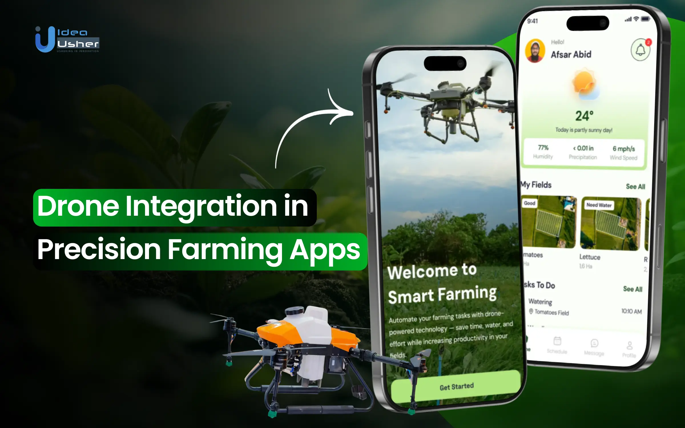
Farmers today face challenges like unpredictable weather, labor shortages, and the constant need to maximize efficiency. Drones are emerging as powerful allies, giving farmers a bird’s-eye view of their fields. With drone-integrated farming apps, they can capture aerial images, monitor crop health, track soil and irrigation patterns, and transform raw data into actionable insights that improve yields and optimize resource use.
For businesses, this shift is more than a technological upgrade; it’s a growing opportunity. The agriculture industry is increasingly seeking digital solutions that merge mobility with precision. By launching drone-integrated farming apps, businesses can address this demand, provide practical solutions, and strengthen their position in the evolving landscape of sustainable agriculture.
In this blog, we’ll dive into how drone integration in precision farming apps works, highlight the most important features, and explain why it’s becoming an essential tool for modern farming. With our experience in building advanced digital solutions across industries, IdeaUsher helps businesses create apps that deliver real value to farmers while driving measurable growth.

The Role of Drones in Precision Farming
Drones have become an important tool in modern agriculture. They give farmers real-time insights from the sky. They improve precision farming by allowing better monitoring. Drones also optimize resource use and reduce operational inefficiencies.
1. Precision Spraying and Variable Rate Application
Drones equipped with advanced sensors enable the precise application of pesticides, herbicides, and fertilizers, ensuring that only targeted areas receive treatment. This approach reduces chemical usage, minimizes environmental impact, and lowers operational costs.
Example: Farmonaut’s drone technology has revolutionized precision farming by enabling accurate crop monitoring and efficient fertilizer application, leading to reduced waste and improved resource use.
2. Soil and Field Analysis with Drones
Drones equipped with multispectral and hyperspectral sensors provide detailed 3D maps of farms, allowing for precise analysis of soil health. This data helps farmers make informed decisions about seed distribution, irrigation, and nutrient management.
Example: A case study from Virginia Tech highlights the adoption of Unmanned Aerial Systems (UAS) for soil analysis in the Mid-Atlantic United States, demonstrating how drones can assist in assessing soil conditions and informing agricultural practices.
3. Drone-Assisted Irrigation Management
Drones play a crucial role in irrigation management by identifying areas of water stress and optimizing water usage. This leads to more efficient irrigation practices and conservation of water resources.
Example: Farmonaut’s drone technology in California has demonstrated significant time and cost savings in irrigation management, coupled with positive environmental impacts, making a compelling case for its adoption in precision farming.
4. Automated Planting and Seeding by UAVs
Unmanned Aerial Vehicles (UAVs) are increasingly being used for planting and seeding, offering precise control over seed placement and depth. This automation reduces labor costs and enhances planting efficiency.
Example: In a U.S. case study, research indicates that UAVs can effectively manage planting operations, particularly in large-scale agricultural settings.
5. Livestock Monitoring via Advanced Drone Capabilities
Drones equipped with thermal and infrared sensors are utilized for monitoring livestock health, behavior, and location. This technology aids in early disease detection and improves overall herd management.
Example: In the U.S., drone-assisted livestock monitoring has been implemented to enhance animal welfare and optimize grazing patterns, contributing to more sustainable livestock farming practices.
6. Early Detection of Plant Diseases and Pest Infestations
Drones equipped with imaging technologies can detect early signs of plant diseases and pest infestations, allowing for timely intervention and targeted treatment. This proactive approach reduces crop loss and minimizes the use of chemical treatments.
Example: A study conducted in California’s Yolo County utilized drone-based multispectral imaging combined with deep learning algorithms to detect branched broomrape infestations in tomato crops, achieving over 88% accuracy in early detection.
7. Enhancing Crop Yield through Data-Driven Insights
Drones provide farmers with real-time data and analytics, enabling them to make informed decisions that enhance crop yield and overall farm productivity.
Example: PrecisionHawk’s drone platform helps Midwest corn farmers by providing detailed vegetation indices and 3D maps, allowing early nutrient deficiency detection, precise fertilizer adjustments, and optimized irrigation, leading to increased yields and lower costs.
Global Drone Adoption in Smart Farming
The global agriculture drones market size was estimated at USD 2.74 billion in 2024 and is projected to reach USD 10.26 billion by 2030, growing at a CAGR of 25.0% from 2025 to 2030. This growth is driven by the increasing adoption of drones for crop spraying, precision monitoring, and data-driven farm management.

Rantizo, an agriculture drone spraying company, raised USD 6 million in its oversubscribed Series A round. The company’s drone-as-a-service platform now operates across 30 states, showcasing strong investor confidence in drone-integrated solutions for farming.
Guardian Agriculture, another ag-based startup, raised USD 10.5 million to scale its eVTOL crop protection drone system. By combining autonomous drone technology with software-driven precision spraying, the company highlights the commercial viability of drone-enabled crop management solutions.
DroneDeploy, another prime example in this niche, raised USD 25 million in a Series C round to expand its aerial data platform. Widely used in agriculture for crop mapping and health analysis, DroneDeploy underscores how drone-integrated apps are becoming essential tools for modern farm operations.
The drone agriculture industry is changing how we produce, monitor, and improve food. Investing in a drone-integrated farming app puts it at the forefront of this agricultural shift. With rapid market growth, rising investor interest, and proven use cases, drone-powered solutions hold significant promise for growth, sustainability, and long-term profit.

Why Integrating Drones into Farming Apps Matters?
The real impact of drones in agriculture lies not just in aerial views but in their integration with farming apps that transform raw data into real-time, actionable intelligence for farmers.
1. Precision in Data Collection & Analysis
Drones equipped with multispectral, hyperspectral, and thermal sensors capture subtle crop and soil variations invisible to the naked eye. Integrated apps process this data into decision-ready insights, guiding nutrient application, irrigation, and pest control with pinpoint accuracy.
2. Real-Time Monitoring & Decision Making
Instead of periodic field checks, drones deliver continuous, real-time monitoring of crops and environmental conditions. Farming apps convert this live data into instant alerts and recommendations, enabling farmers to prevent losses by acting before problems escalate.
3. Automation & Workflow Optimization
Drone farming apps optimize workflows by automating crop surveys, mapping growth patterns, and enabling precision spraying or seeding. The app acts as a central hub, coordinating drone operations and reducing manual labor while enhancing decision efficiency.
4. Cost Efficiency & Resource Optimization
By turning aerial insights into precise action, drones ensure water, fertilizers, and pesticides are applied only where required. This approach reduces waste, lowers input costs, and minimizes environmental impact while maintaining high crop productivity.
5. Scalability & Farm Management at Scale
Drones help manage vast agricultural areas efficiently. Integrated apps aggregate drone data into a unified dashboard, enabling large-scale farms to coordinate operations, standardize monitoring, and ensure consistent productivity across thousands of acres.
6. Enhanced Sustainability & Environmental Stewardship
Drone-enabled apps support sustainable farming by reducing chemical runoff, improving soil health, and optimizing water usage. Long-term drone data trends allow planning of crop rotation and biodiversity practices, ensuring productivity aligns with ecological balance.
Key Features of Drone-Integrated Precision Farming Apps
Drone-integrated precision farming apps combine aerial intelligence with smart analytics to give farmers complete visibility of their fields. These features collect data and transform it into practical advice that results in clear improvements in productivity.

1. Real-Time Field Mapping & Aerial Imaging
Drone farming apps deliver real-time, high-resolution maps of fields using multispectral, hyperspectral, and thermal imaging. Unlike satellite data, drones revisit exact spots on demand, helping farmers spot soil variations, crop stress zones, and micro-environmental shifts with unparalleled precision.
2. Crop Health Analysis & Stress Detection
By applying vegetation indices such as NDVI (Normalized Difference Vegetation Index) and thermal anomaly detection, these apps flag nutrient deficiencies, water stress, or early disease risks. Farmers shift from reactive actions to proactive interventions, reducing crop losses and improving field resource allocation.
3. Automated Irrigation Management
Drone-integrated apps process aerial moisture readings to create data-driven irrigation schedules. Advanced setups connect directly with smart irrigation systems, ensuring water is applied precisely where needed. This eliminates guesswork, conserves water, and improves both soil health and crop resilience.
4. Precision Fertilization and Pest Management
Using aerial imaging combined with AI-driven analysis, these apps identify nutrient-deficient zones or pest infestations. Farmers receive exact input recommendations, enabling variable-rate application that lowers costs, limits environmental impact, and sustains crop health without excessive fertilizer or pesticide use.
5. Field Activity Tracking & Operational Insights
These apps go beyond monitoring by logging planting, spraying, irrigation, and fertilization records into a centralized dashboard. This operational history supports efficiency analysis, compliance reporting, and sustainability audits, while also identifying underutilized labor or equipment for better farm resource planning.
6. Integration with Farm Management Systems
Drone farming apps integrate seamlessly with farm management platforms, weather forecasts, soil databases, and market pricing tools. This ecosystem approach ensures drone data is contextualized, helping farmers align operational decisions with market dynamics, environmental conditions, and resource availability.
7. Predictive Analytics & Yield Forecasting
By combining drone datasets with AI and machine learning, apps forecast yield outcomes and anticipate risks. These predictions empower farmers to plan harvest timelines, manage supply chains, and make confident financial decisions backed by accurate agricultural intelligence.
8. Reporting & Visualization Tools
Farmers access visual dashboards with heatmaps, 3D terrain models, and growth time-lapses that simplify complex datasets. These visualizations enhance communication with investors, agronomists, and regulators while enabling quick decision-making supported by transparent, evidence-based reporting and compliance documentation.
9. Scalability & Multi-Field Management
Drone-integrated apps are designed for scalability, allowing simultaneous multi-field management across diverse geographies. Farmers can automate drone schedules, compare conditions across farms, and generate consolidated reports, making the system suitable for both smallholder operations and expansive commercial agribusinesses.

Development Process of a Drone-Integrated Precision Farming App
Building a drone-integrated precision farming app requires more than just adding aerial imaging. Our development process focuses on creating a solution that converts raw drone data into useful information. This is backed by strong design, a user-friendly layout, and execution that follows the rules.

1. Consultation
We start with a detailed consultation that aligns your app idea with market needs and farmer requirements, including real-time monitoring, predictive analytics, and farm activities. Our experts review your business model, identify ways to make money, and develop a plan that accounts for both costs and growth potential.
2. Identifying Drone Data Inputs
We identify and integrate RGB, multispectral, thermal, and GPS datasets essential for field mapping and stress detection. Our developers configure APIs and upload systems to support varied drones, ensuring the app processes and standardizes drone-captured data accurately and consistently.
3. Designing App Architecture
Our team designs a scalable architecture with mobile/web frontends, cloud-based analytics, secure databases, and robust APIs. This ensures seamless drone integration, real-time data processing, and smooth connectivity with external systems like IoT sensors, delivering reliability even for large-scale farm operations.
4. Data Processing & Analytics Pipelines
Our developers build pipelines to process drone imagery into georeferenced maps, vegetation index analyses, and predictive AI models. The system delivers actionable insights such as irrigation alerts and yield forecasts, enabling farmers to make faster, more accurate operational decisions.
5. Building an Intuitive User Interface
We design farmer-friendly dashboards with interactive field maps, irrigation overlays, and growth trends. The interface emphasizes simplicity, allowing seamless drone data uploads and quick interpretation of results, making advanced analytics accessible to farmers without requiring technical expertise.
6. Drone Data Integration
Our team integrates APIs from DJI, Parrot, and senseFly while supporting manual uploads for non-standard drones. By unifying diverse inputs into a standardized format, the app ensures drone data is usable, consistent, and actionable across different farming environments.
7. Farm Management & Operational Features
We extend the app beyond drone data by building modules for planting schedules, labor tracking, equipment monitoring, and compliance-ready reporting. These features transform the solution into a complete farm management platform, centralizing both aerial intelligence and operational insights.
8. Security & Regulatory Compliance
Our developers implement data encryption, role-based access, and secure authentication to protect sensitive farm information. We also ensure compliance with FAA drone regulations and global data privacy standards, making the platform trustworthy for large-scale enterprise and farmer adoption.
9. Testing & Field Validation
We test the app with real drone datasets across diverse farm scales, validating crop health analytics and predictive models. Farmers are directly involved in usability testing, ensuring intuitive workflows, reliable outputs, and features tailored to practical agricultural conditions.
10. Deployment & Maintenance
Our deployment covers iOS, Android, and web platforms, with continuous support to refine AI models, fix issues, and enhance usability. Regular updates ensure compatibility with new drone technologies, evolving farming practices, and user-driven improvements.
Cost Breakdown of Drone-Integrated Precision Farming App Development
Developing a drone farming app includes several stages. Each stage needs specific resources, skills, and technology integration. A clear cost breakdown helps businesses estimate budgets realistically. This approach allows them to plan investments confidently.
| Development Phase | Estimated Cost | Description |
| Consultation & Planning | $5,000 – $10,000 | Initial meetings, requirement gathering, and defining the business goals, objectives, and technical scope. |
| UI/UX Design | $6,000 – $12,000 | Designing farmer-friendly interfaces, dashboards, and interactive maps for easy navigation and adoption. |
| Backend Development & Architecture | $15,000 – $25,000 | Building robust backend, APIs, and cloud infrastructure to process drone and farm data efficiently. |
| Drone Data Integration | $10,000 – $18,000 | Connecting with drone APIs, standardizing data formats, and enabling real-time imagery ingestion. |
| Data Processing & Analytics | $12,000 – $20,000 | Implementing AI/ML models for crop health analysis, predictive insights, and precision farming recommendations. |
| Mobile & Web App Development | $10,000 – $18,000 | Developing Android, iOS, and web apps with synchronized features for farmers and agribusiness managers. |
| Testing & Field Validation | $6,000 – $11,000 | Validating app performance with real drone datasets, farmer usability testing, and fixing issues. |
| Deployment & Maintenance | $6,000 – $12,000 | Launching apps across platforms, providing updates, fixing bugs, and integrating feedback for improvements. |
Total Estimated Cost: $60,000 – $128,000
Note: These costs provide a realistic estimate of building a robust drone farming app, but the final investment depends on features, integrations, and scalability goals.
Consult with IdeaUsher to get a tailored roadmap and precise budget plan.
Tech Stack for Drone-Integrated Farming Apps
A drone-integrated precision farming app requires a tech stack capable of handling real-time drone data, AI analytics, scalable storage, and cross-platform accessibility. Below is a detailed breakdown with in-depth explanations.
1. Frontend
The frontend is the user-facing interface that presents dashboards, interactive maps, real-time alerts, and analytics in a clear and intuitive way. It must work seamlessly on mobile devices and tablets, providing farmers with actionable insights at their fingertips.
- Flutter: Provides high-performance, cross-platform mobile app development. Its smooth animations, customizable widgets, and fast rendering make it ideal for displaying complex maps and live drone data.
- React Native: Allows developers to write reusable components for both iOS and Android. It also supports integration with native drone SDKs, making it easier to process live drone feeds and control devices.
- HTML5/CSS3: Powers web-based dashboards, allowing farmers to access the app from any browser. Its responsive design ensures that maps, charts, and visualizations scale across devices, improving accessibility.
2. Backend
The backend is the engine of the app, managing business logic, drone data processing, API requests, and AI model execution. It ensures smooth communication between drones, cloud services, databases, and the frontend.
- Node.js: Handles real-time, asynchronous data streams from drones and IoT devices. Its non-blocking architecture supports live monitoring and notifications without lag.
- Django: Provides a structured and secure framework for database operations, user management, and AI model integration. Its modular structure makes scaling and maintenance easier.
- GraphQL: Efficiently handles API queries, allowing the frontend to request exactly the data it needs. This reduces bandwidth usage and speeds up response times for real-time dashboards.
3. Database
The database stores both structured and unstructured data, ensuring quick retrieval, secure storage, and support for geospatial analysis. It must be able to manage large volumes of drone imagery, telemetry data, and historical farm records.
- PostgreSQL: Ideal for relational farm data, such as field records, crop types, and GPS coordinates. PostGIS supports advanced geospatial queries for mapping and analysis.
- MongoDB: Flexible storage for unstructured data like high-resolution drone images, sensor logs, and JSON metadata. It scales easily to accommodate growing datasets.
- Redis: An in-memory database for caching frequently accessed data, improving performance for real-time dashboards, alert systems, and repeated queries.
4. Drone SDKs and APIs
Drone SDKs and APIs allow the app to communicate with drones, control flights, capture imagery, and process mapping data. Integration ensures flexibility to support multiple drone platforms.
- DJI Mobile SDK: Provides comprehensive flight control, telemetry, and real-time image streaming. Enables automated missions and precise aerial monitoring.
- DroneDeploy API: Cloud-based mapping and flight planning, allowing seamless automated data capture and processing for large farm areas.
- Pix4D: Converts raw drone images into orthomosaics, 3D models, and precision maps for crop and soil analysis.
- OpenDroneMap: Open-source tool for additional image processing, geospatial data extraction, and customizable mapping pipelines.
5. AI and Machine Learning
AI/ML modules turn raw drone imagery into actionable insights, enabling crop health monitoring, pest detection, yield prediction, and anomaly identification.
- TensorFlow: Optimized for production deployment, including TensorFlow Lite for running AI models directly on mobile devices. Supports image recognition, segmentation, and predictive modeling.
- PyTorch: Provides flexibility for custom AI model development and experimentation. Ideal for creating advanced models tailored to specific crops or farm conditions.
- scikit-learn: Lightweight machine learning library for statistical analysis, regression, and predictive modeling on structured farm data. Complements deep learning models for quick data insights.
6. IoT and Cloud Integration
IoT and cloud services enable real-time communication between drones, sensors, and the backend, while offering scalable storage and computational power. They allow farmers to access insights anywhere and support integration with other smart farm devices.
- AWS IoT: Provides scalable infrastructure for managing device communication, real-time telemetry, and secure data handling from drones and sensors.
- Azure IoT Hub: Enterprise-grade IoT platform that supports analytics, AI integration, and secure device management across multiple farm locations.
- Google Cloud Platform (GCP): Offers AI/ML services, storage, and processing power for high-resolution imagery and large datasets. Supports real-time analysis and predictive modeling.
- MQTT Protocol: Lightweight, reliable messaging protocol for IoT devices. Enables efficient communication between drones, sensors, and cloud servers with minimal bandwidth.
Challenges and How to Overcome Them
Building a drone-integrated precision farming app is not only about technology but also about addressing real-world hurdles in data, connectivity, compliance, and adoption. Below are the key challenges and how we solve them effectively.
1. Handling High-Volume Drone Data
Challenge: Drones produce vast volumes of high-resolution images and videos, making it difficult to store, process, and analyze them efficiently. This often results in system slowdowns and network bottlenecks for farmers and businesses.
Solution: Our developers use edge computing to process the data from drone captures before uploading it into the mobile app. Combined with cloud-based auto-scaling storage and advanced compression techniques, our approach ensures smooth performance even with large-scale datasets.
2. Ensuring Accurate AI Predictions
Challenge: AI models trained in one geography often fail when applied to new soil, climate, and crop conditions, leading to inaccurate insights and poor decision-making in precision agriculture.
Solution: We train localized AI models for specific crops and regions while applying transfer learning for scalability. By updating models seasonally with fresh drone imagery, our predictions remain accurate and context-specific.
3. Drone and App Integration Issues
Challenge: Every drone comes with its own SDKs and APIs, making integration with apps complex. Supporting multiple platforms slows down development and increases technical challenges.
Solution: We implement a modular architecture with plug-in-based API integrations, starting with popular SDKs like DJI. By creating an abstraction layer, our app ensures seamless drone compatibility regardless of hardware brand.
4. Real-Time Connectivity in Remote Areas
Challenge: Farms located in remote areas often lack reliable internet connectivity, which disrupts real-time data sync and cloud-based operations in drone farming apps.
Solution: Our apps use an offline-first architecture where drones temporarily store data and sync it later when online. With lightweight protocols like MQTT, we ensure uninterrupted functionality even in low-bandwidth zones.
5. Farmer Adoption and Ease of Use
Challenge: Many farmers are not familiar with advanced technology, making complicated UIs and technical terms a barrier to adopting drone-integrated apps.
Solution: We design intuitive dashboards with visuals instead of jargon, provide guided tutorials, and enable local language support. Tiered app versions offer both basic and advanced features tailored to farm size.
Conclusion
Drone integration is changing how precision farming apps provide value. It gives farmers faster, more accurate, and data-rich insights. Drones monitor crop health, map fields, and plan irrigation. They reduce guesswork and help farmers make better decisions. Drones can quickly cover large areas, which improves efficiency and lowers costs and labor. As technology advances, drones will significantly impact sustainable and profitable agriculture. Embracing this innovation helps farmers become more productive and resilient in a competitive agricultural setting.
Why Choose IdeaUsher for Drone-Powered Farming App Development?
At IdeaUsher, we specialize in building precision farming apps that seamlessly integrate drones to deliver real-time field insights, crop health monitoring, and efficient farm management. Our solutions are designed to optimize agricultural operations while reducing manual efforts and costs.
Why Work with Us?
- AgriTech Expertise: We bring deep expertise in IoT, AI, and drone integration to deliver impactful farming solutions.
- Custom Solutions: Every app is tailored to unique farming requirements, ensuring scalability and efficiency.
- Proven Results: With successful AgriTech projects in our portfolio, we know how to transform concepts into practical applications.
- Future-Ready Development: We design apps that adapt to evolving technologies and farming needs.
Explore our portfolio to see how we helped other business projects with cutting-edge technology.
Let’s connect with us to explore how your drone-integrated farming app can enhance efficiency and resilience in future farming.


FAQs
Drones provide aerial imagery and real-time data that help farmers monitor crop health, soil conditions, and irrigation patterns. This improves accuracy in farm management, reduces manual labor, and allows timely interventions for better yield and efficiency.
Drones capture high-resolution images, multispectral data, and thermal readings. These insights detect plant stress, assess soil moisture, and identify pest or disease outbreaks early, giving farmers actionable information to make informed decisions and improve farm productivity.
While initial investment may seem high, drones reduce costs over time by minimizing resource wastage, optimizing input use, and preventing large-scale crop losses. Their efficiency and accuracy make them a cost-effective solution for long-term farming success.
Yes, drones integrated with AI enhance analytics by processing aerial data into actionable insights. AI can identify crop patterns, predict yields, and automate monitoring, helping farmers optimize operations and achieve more accurate, data-driven farming practices.


