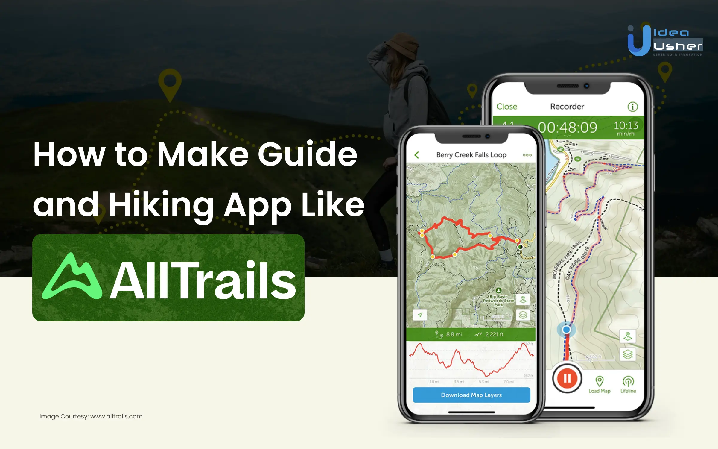
Setting off on the journey to develop your own guide and hiking app, akin to the widely acclaimed AllTrails, might feel like venturing into unexplored terrain. Yet, fear not! In today’s digital era, where adventure is at our fingertips, creating your app is more achievable than ever before. Picture a world where outdoor enthusiasts effortlessly unearth new trails, meticulously plan awe-inspiring hikes, and enthusiastically share their conquests all seamlessly within your app. The allure is undeniable, isn’t it?
In this guide, we’ll explore every step, like studying what people want and picking the right tools to build an app that shows trails, keeps folks safe, and brings hikers together.
Come along as we discover how to make a cool app that’s like having a knowledgeable buddy on your outdoor adventures, just like AllTrails.

What is a Guide and Hiking App?
Guide and hiking apps are your digital trail companions, offering a treasure trove of information and assistance for outdoor enthusiasts. These apps serve as virtual guides, providing detailed maps, trail routes, and crucial details about terrain, difficulty levels, and points of interest. They help hikers navigate safely through unknown paths, offering insights on weather conditions, nearby amenities, and even wildlife sightings. Some apps also foster a community, allowing users to share experiences and tips. With their GPS capabilities, these tools ensure adventurers stay on track, enhancing the overall hiking experience by merging technology with nature’s wonders.
How Does a Guide and Hiking App Like Alltrails Work?
A guide and hiking app like AllTrails operates as a comprehensive platform tailored for outdoor enthusiasts.
Trail Database and Selection
AllTrails boasts a comprehensive database, offering access to a plethora of trails meticulously curated by a combination of seasoned hikers, park authorities, and outdoor organizations. Users can delve into an array of trail options, each accompanied by detailed maps showcasing essential information such as elevation, distance, and difficulty ratings. This feature empowers hikers to make informed choices aligned with their preferences and skill levels.
GPS Integration for Seamless Navigation
The app’s GPS integration lies at the core of its functionality. It enables real-time tracking of users’ locations on trails, ensuring they stay on course and stay abreast of their surroundings. This not only enhances safety but also boosts confidence among hikers, particularly in unfamiliar terrains.
Information Hub and Decision Support
AllTrails acts as an invaluable information hub. It provides vital insights into trail conditions, weather forecasts, and user-generated reviews. This wealth of information aids hikers in planning their adventures and making informed decisions before embarking on a hike.
Community Engagement and Contribution
The app thrives on community engagement. Users actively contribute by sharing their experiences through reviews, photos, and tips. This collective knowledge creates a dynamic platform where outdoor enthusiasts can connect, learn from each other, and foster a sense of camaraderie.
Premium Features and Subscription Models
AllTrails offers additional premium features through subscription models. These include offline map access and extra trail insights, enriching the user experience for those seeking enhanced functionalities and convenience.
Guide and Hiking App: Market Growth Stats
The global adventure tourism market has surged significantly, reaching over $800 billion in 2024, according to recent industry reports. This rapid growth highlights a substantial opportunity for developing hiking and guide apps. As more travelers seek immersive and adrenaline-filled experiences, the demand for digital tools that enhance exploration, ensure safety, and provide real-time information is rising, making this niche both timely and highly profitable for innovation.

Source: Grandviewresearch
Hiking, being a quintessential adventure activity, is witnessing a surge in popularity among travelers craving outdoor escapades. Crafting user-friendly, informative apps catering to hikers’ needs—offering trail maps, safety tips, and real-time guidance—can tap into this lucrative market. As travelers prioritize exploration and unique experiences, these apps stand as essential tools, poised to capitalize on the growing demand for adventure tourism while enriching users’ hiking experiences globally.
Must-Have Features in a Guide and Hiking App Like Alltrails
If you’re considering developing a hiking app akin to AllTrails, here are some must-have features to consider integrating:
1. Extensive Trail Database
A robust collection of trails with detailed information including difficulty levels, length, elevation, and user reviews is essential. Users should be able to filter trails based on their preferences and skill level.
2. Interactive Maps and GPS Navigation
Real-time GPS tracking, offline maps, and trail-following capabilities are vital for users to navigate without internet access. Incorporating features like waypoints, marking favorite spots, and detailed trail overlays enriches the hiking experience.
3. Trail Reviews and Ratings
User-generated content is gold. Reviews, ratings, and photos shared by fellow hikers aid in decision-making, offering insights into trail conditions, seasonal variations, and hidden gems.
4. Safety Features
Safety should always be a priority. Integrating features like emergency alerts, offline access to safety information, weather forecasts, and the ability to share itineraries with friends or family can be life-saving.
5. Community and Social Elements
Building a community within the app fosters engagement. Users can share experiences, tips, and even organize group hikes. Features like leaderboards, challenges, or badges can encourage participation.
6. Customization and Personalization
Users love tailored experiences. Allow them to create custom trails, save favorite routes, set personal goals, and receive recommendations based on their preferences.
7. Integration with Wearables and Devices
Compatibility with wearable devices like smartwatches or fitness trackers can enhance the app’s functionality, allowing users to track their progress seamlessly.
8. Educational Content
Providing informative content about flora, fauna, history, and geology of the trails adds educational value. This can be through articles, audio guides, or interactive elements.
9. Offline Functionality
Not all hiking trails have reliable internet access. Offline mode for maps, trail details, and basic functionalities ensures usability in remote areas.
10. Monetization Features
While the app can offer a lot for free, premium features like advanced trail statistics, exclusive trails, or ad-free experiences can entice users to subscribe.
11. Accessibility Features
Consideration for users with disabilities is crucial. Providing information about accessible trails or features like voice-guided navigation can make the app more inclusive.
12. Regular Updates and Maintenance
Continuously updating trail information, fixing bugs, and incorporating user feedback helps in maintaining the app’s relevance and reliability.

Benefits of Developing a Guide and Hiking App Like Alltrails For Businesses
Crafting a guide and hiking app akin to AllTrails presents multifaceted benefits, not just for outdoor enthusiasts but for businesses aiming to expand their reach and impact. Here’s a closer look at how such an app can serve as a game-changer:
1. Engaging a Niche Market
Specialized apps catering to adventure seekers, hikers, and nature enthusiasts tap into a focused, passionate user base. By aligning with this niche, businesses can forge stronger connections and loyalty among users who value outdoor experiences.
2. Amplifying Brand Visibility
Developing an app akin to AllTrails offers businesses a direct channel to showcase their brand. Seamlessly integrating services, offers, or products within the app can enhance visibility, fostering brand recall while users explore trails and plan adventures.
3. Facilitating Community Building
A guide and hiking app isn’t merely a tool—it’s a platform to foster a community. Businesses can leverage this space to encourage user interactions, reviews, and shared experiences, fostering a sense of belonging among users while organically promoting their offerings.
4. Data-Driven Insights
Incorporating analytics within the app provides businesses with invaluable insights into user behavior, preferences, and popular trails. This data-driven approach empowers informed decision-making, enabling businesses to tailor their offerings more effectively.
5. Collaboration Opportunities
Partnering with local tour operators, gear suppliers, or accommodation providers can create synergistic relationships within the app. Offering exclusive deals or collaborations further enriches user experiences while expanding the business network.
6. Sustainable Revenue Streams
Integrating subscription models, premium features, or sponsored content within the app offers sustainable revenue streams. Businesses can monetize the app directly while offering enhanced services to users seeking more comprehensive hiking experiences.
7. Adapting to Changing Travel Trends
In a dynamic travel landscape, flexibility is key. An app like AllTrails allows businesses to adapt swiftly to evolving travel trends, incorporating new trails, features, or services to meet user demands effectively.

Key-Steps to Develop a Guide and Hiking App Like Alltrails
Crafting a thriving hiking application akin to Alltrails demands meticulous planning, flawless execution, and an acute eye for details. Here’s an outline of essential steps:
Define Your Unique Niche and Audience:
- Zoom in on a specific region or hiking type: Standing out can be achieved by focusing on niches like family-friendly trails, challenging mountain paths, or scenic routes within national parks.
- Identify your ideal user: Delve into their demographics, hiking experience, and needs to shape the app’s features and utilities.
Aggregate and Curate Trail Information:
- Forge partnerships with trail organizations and governmental bodies: Secure precise and updated data on trail lengths, difficulty levels, elevation details, and notable spots.
- Encourage user contributions: Foster a dynamic database by allowing hikers to submit reviews, photos, and trail updates, promoting a community-driven approach.
Design an Intuitive User Interface:
- Prioritize seamless and intuitive navigation: Ensure easy trail discovery, preference filtering, and access to crucial information like offline maps and turn-by-turn guidance.
- Incorporate captivating visuals: Utilize top-tier maps, trail images, and elevation specifics to captivate users and showcase the trails’ allure.
Develop Core Features and Functionalities:
- Interactive GPS-based mapping: Enable users to track their progress, spot their location on the trail, and discover nearby attractions.
- Offline map availability and downloadable trail data: Empower users to navigate even in remote areas without internet connectivity.
- Thorough trail descriptions and reviews: Offer comprehensive trail insights covering difficulty, length, amenities, user reviews, and elevation data.
- Route customization and sharing: Allow users to devise personalized itineraries, save preferred trails, and share them with peers.
- Safety protocols: Embed emergency contacts, offline weather updates, and an SOS feature for unforeseen situations.
Monetization Approach:
- Freemium model: Provide basic features for free and introduce premium offerings like downloadable maps, ad-free experiences, or advanced filters through a subscription model.
- In-app purchases: Offer additional features such as trail guides, offline map downloads, or virtual achievements for completing challenges.
- Collaborations: Partner with local businesses and outdoor brands for sponsored content, discounts, or trail recommendations.
Testing and Launch:
- Conduct extensive beta testing: Garner feedback from potential users to refine features and eradicate glitches pre-launch.
- Develop a robust marketing strategy: Generate hype via social media campaigns, influencer partnerships, and collaborations with outdoor platforms.
- Continuous enhancements: Regularly introduce new trails, features, and functionalities in response to user feedback and market dynamics.
Additional Recommendations:
- Integrate social media sharing: Encourage users to share experiences and images on social platforms, fostering a community around the application.
- Personalization: Enable users to personalize profiles, set fitness goals, and track progress for heightened engagement.Accessibility focus: Ensure inclusivity by incorporating features like voice controls and text-to-speech navigation for users with disabilities.
Essential Tech-Stack Needed for Developing a Guide and Hiking App Like Alltrails
Here’s a breakdown of the essential tech stack required for developing a guide and hiking app similar to AllTrails:
Frontend Development:
- Programming Languages:
- JavaScript/TypeScript: Utilized for building interactive and dynamic user interfaces.
- HTML/CSS: Fundamental for structuring content and styling.
- Frameworks/Libraries:
- React Native or Flutter: Enables cross-platform development for both iOS and Android, reducing development time and effort.
- Redux or MobX: State management libraries to handle app-wide state efficiently.
- UI/UX Design Tools:
- Sketch, Adobe XD, or Figma: Used for designing and prototyping the app’s interface and user experience.
Backend Development:
- Server-side Technologies:
- Node.js: Known for its scalability and event-driven architecture, ideal for handling a large number of concurrent requests.
- Express.js or Hapi.js: Lightweight frameworks for building robust and scalable APIs.
- Database:
- MongoDB or PostgreSQL: MongoDB for its flexibility with unstructured data like trail information, and PostgreSQL for structured data like user details and preferences.
- Cloud Services:
- Amazon Web Services (AWS) or Google Cloud Platform (GCP): For scalable storage, hosting, and other cloud-based services.
- Firebase: Provides real-time database, authentication, and cloud functions, facilitating rapid development and deployment.
Mapping and GPS Integration:
- Mapping Services:
- Google Maps API or Mapbox: Offers functionalities like trail mapping, GPS navigation, and offline maps crucial for hiking apps.
- OpenStreetMap: An open-source alternative for mapping, allowing customization and community-driven updates.
- Geolocation Services:
- HTML5 Geolocation API: Utilized for accessing a user’s current location, integral for providing accurate trail tracking and navigation.
Additional Integrations:
- Push Notifications:
- Firebase Cloud Messaging (FCM) or Apple Push Notification Service (APNS): Essential for sending timely updates, trail alerts, or safety notifications to users.
- Analytics and Monitoring:
- Google Analytics or Mixpanel: Used to gather insights into user behavior, track app performance, and identify areas for improvement.
- Authentication and Security:
- OAuth or JSON Web Tokens (JWT): Ensures secure user authentication and data transmission within the app.
- Payment Gateways (if monetization is a part of the app strategy):
- Stripe or PayPal: Facilitates secure payment transactions for in-app purchases, premium subscriptions, or other monetization models.
Development and Collaboration Tools:
- Version Control:
- Git: Essential for version control, allowing collaboration among developers and tracking changes in the codebase.
- Project Management:
- Jira, Trello, or Asana: Used for task management, sprint planning, and tracking project progress.
- Communication:
- Slack or Microsoft Teams: Facilitates seamless communication among the development team, stakeholders, and any external collaborators.

Top Examples of Guide and Hiking Apps in the Market
With so many amazing trails to explore in the US, it’s no wonder there are so many great guide and hiking apps available to help you plan your next adventure. Here are some top options to consider:
Gaia GPS
This app is a favorite among serious hikers and backpackers. It offers detailed topographic maps, offline functionality, and a variety of tools for route planning and navigation. Gaia GPS also has a library of downloadable maps from various sources, including national parks, forests, and USGS quads.
Hiking Project
This app is great for finding new trails and exploring hidden gems. It features a curated selection of trails from the Mountain Project community, with detailed descriptions, photos, and user reviews. Hiking Project also offers trip planning tools, elevation profiles, and offline maps.
Cairn
This app focuses on safety and preparedness for your hikes. It features a built-in SOS beacon, offline maps, and a trip-sharing function that lets your loved ones track your progress. Cairn also offers weather reports, trail alerts, and a library of safety tips and resources.
FarOut
This app is specifically designed for thru-hikers and long-distance trekkers. It provides comprehensive trail guides with detailed maps, mile-by-mile descriptions, resupply points, and campgrounds. FarOut also offers offline maps, elevation profiles, and a community forum for hikers to connect and share tips.
Conclusion
Creating an app like AllTrails isn’t just about coding—it’s about sharing the joy of exploration. By blending tech smarts with user needs, we can craft an app that opens doors to nature’s wonders. From helping folks find trails to keeping them safe, this journey explores the recipe for a digital guide and hiking pal. So, whether it’s discovering hidden paths or connecting with fellow adventurers, this endeavor unveils the essence of building a companion that brings the beauty of the outdoors right to your fingertips. Let’s step forward, inspired to create an app that fuels the wanderlust in every nature enthusiast.
What Idea Usher Can Do For You?
Our expertise spans from conceptualizing user-centric features to crafting a seamless user interface. Leveraging our adeptness in market analysis, we identify niche opportunities, ensuring the app stands out. Idea Usher’s tech prowess shines through in selecting the perfect tech stack, integrating GPS functionalities, and fostering an engaging community platform. With a keen eye on user safety and experience, we weave together innovation and practicality, shaping an app that resonates deeply with nature enthusiasts, encapsulating the spirit of adventure in every digital trail.

Frequently Asked Questions
Q. How Do I Ensure Accurate Trail Data and Maps for the App?
Ensuring accurate trail data demands meticulous sourcing and verification processes. Leverage APIs from reliable mapping services, collaborate with park authorities, and employ user feedback mechanisms to maintain updated trail information. Consistency and reliability in data sourcing are crucial for user trust.
Q. What Tech Stack Should I Consider for App Development?
Selecting the right tech stack influences your app’s performance. Consider using languages like Swift (iOS) and Kotlin (Android) for native app development. For backend and database, options like Node.js, MongoDB, or PostgreSQL offer scalability and flexibility.
Q. How Can I Enhance User Engagement in the App?
User engagement is pivotal. Incorporate gamification elements like badges, challenges, and rewards to motivate users. Implement a social aspect with features for users to share their hikes, interact with fellow adventurers, and contribute to the app’s community.
Q. What Monetization Strategies Work Best for Guide and Hiking Apps?
Choosing the right monetization model is critical. Consider a freemium model with basic features accessible for free, enticing users to upgrade for premium features like advanced trail insights, offline maps, or exclusive content. Additionally, partnerships with outdoor gear brands or tour operators for sponsored content can generate revenue.


