 (+971) 8007 4267
 (+91) 946 340 7140
 (+1) 628 432 4305

A lot of people love spending time on the water, whether it’s for fishing, boating, or just soaking in the views. But navigating the ocean can feel overwhelming, especially for those without much experience. That’s where marine navigation apps like SailGrib WR come in handy. These apps provide essential tools and info to help boaters find their way safely and confidently, making their trips more fun and stress-free. Marine navigation apps are a must-have for boaters, sailors, and fishermen, offering real-time charts, weather forecasts, tide updates, and navigation aids. They help users plan their routes, avoid dangers, and stay safe on the water. Whether you’re a seasoned sailor or a casual boater, a marine navigation app can make your adventure smoother and safer.
The Marine Navigation app market was valued at USD 13.05 billion in 2023, and it’s expected to grow from USD 14.1 billion in 2024 to USD 22.3 billion by 2032, with a steady growth rate of 4.50% annually. More and more people are turning to these apps to enhance their marine adventures, which makes now the perfect time for businesses to get involved and take advantage of this rising demand!
With these trends on the rise, many marine navigation apps are emerging in the US market. In this post, we’ll guide you through creating a user-friendly marine navigation app, like SailGrib WR, packed with great features to help your app stand out. Let’s dive in and show you how to build an app that truly shines!
Key Market Takeaways for Marine Navigation Apps

Source: MarketResearchFuture
This market is seeing strong growth, driven by several key factors. One of the biggest drivers is the increasing volume of marine traffic, which requires more advanced navigation solutions to ensure safety and efficiency on the water. As global trade expands, there’s a rising demand for reliable navigation systems that can handle complex routes and deliver real-time data. Technological advancements in GPS and satellite communications are also making marine navigation apps more accessible and user-friendly for both recreational and commercial users.
Moreover, companies like Timezero, i-Boating, and Rose Point are forming alliances to enhance their software offerings. These partnerships often focus on integrating advanced technologies like artificial intelligence and big data analytics, which improve route planning and provide real-time updates on maritime conditions. Additionally, the integration of broadband VSAT connectivity is allowing users to access high-quality satellite imaging and detailed navigation charts, greatly improving both navigational accuracy and safety.


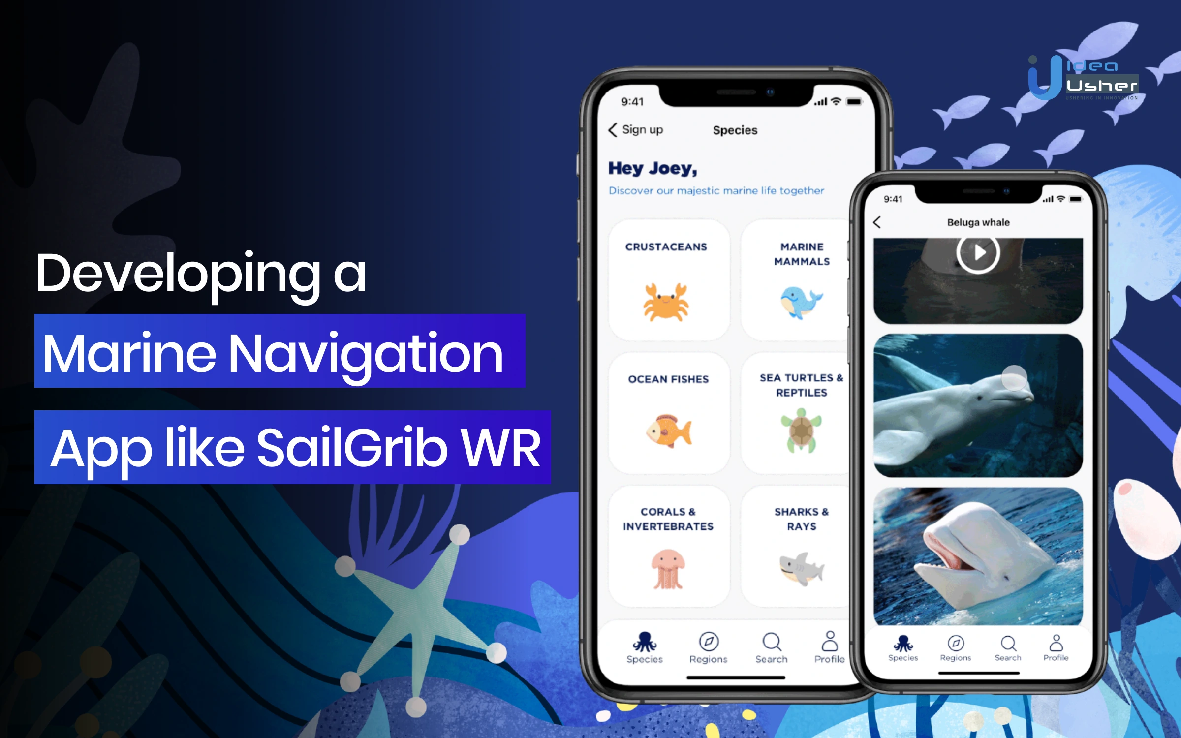
What is the SailGrib WR App?
SailGrib WR is a navigation and weather routing app developed by the French startup SailGrib, initially released in 2017. It is designed specifically for Android devices and caters to boaters, cruisers, and offshore racers, offering features such as weather forecasts, tidal information, and routing capabilities using over 400 polar diagrams. The app has gained popularity, with over 10,000 active users weekly, and its downloads are reportedly doubling each year. SailGrib WR has formed significant partnerships, including collaboration with Weather4D, which allows users to share AIS data over the Internet, enhancing the app’s functionality for real-time navigation and safety.
How Profitable are Marine Navigation AppS like SailGrib WR?
Marine navigation apps, such as SailGrib WR, are becoming increasingly popular among boaters for their convenience and advanced features. These apps not only enhance navigational capabilities but also present significant revenue potential for developers. This analysis will explore CLV, examples of successful apps, revenue statistics, and future revenue predictions for the marine navigation app market.
Customer Lifetime Value
For marine navigation apps, CLV can be influenced by several factors
- Subscription Models: Many marine navigation apps operate on a subscription basis, which can lead to a steady revenue stream. For instance, Navionics charges approximately $25 per year for its services, which has proven attractive to users due to its comprehensive charting capabilities.
- User Engagement: Apps that offer features like real-time weather updates, tide information, and community-driven data tend to retain users longer. For example, Savvy Navvy provides detailed routing based on wind and tide conditions, enhancing user engagement and retention.
- Cross-Selling Opportunities: Apps that integrate additional services (like AIS data or advanced charting) can increase their CLV by offering premium features at an extra cost.
Examples and Revenue Potential
Several marine navigation apps have demonstrated strong market performance:
- Navionics: One of the most established names in the industry, Navionics has a user-friendly interface with auto-routing capabilities. Its annual subscription model generates significant revenue, estimated at millions annually, due to its large user base.
- Savvy Navvy: A newer entrant that has quickly gained traction, Savvy Navvy charges $99 per year for premium features. With over 5,000 five-star reviews, its focus on user experience is likely to drive long-term profitability.
- C-MAP: Known for its extensive charting options and community features, C-MAP offers a free version with in-app purchases and subscriptions starting at around $70.99 annually in Australia.
The global marine navigation software market is projected to grow significantly. According to market research, the industry is expected to see a CAGR of around 10% from 2024 onwards. This can be due to increasing smartphone adoption among boaters and the demand for sophisticated navigational tools.
Business Model of the SailGrib WR
SailGrib WR employs a freemium model, where basic functionalities are available for free while advanced features require a subscription. This model is effective in attracting a wide user base while generating revenue through premium subscriptions.
Subscription Options:
- Monthly: Approximately $4.99
- Annual: Approximately $29.99
- Lifetime purchase: Approximately $99.99
This flexibility caters to both casual app users and serious racers who may require extensive features for specific events.
Revenue Statistics
- User Base Growth: As of early 2017, SailGrib WR was used by over 10,000 sailors weekly, with a significant portion (70%) being European users. The app’s popularity has been growing at a rate of doubling downloads annually.
- Estimated Revenue: Based on the subscription pricing model and user statistics, if 10% of active users opt for the annual subscription ($29.99), this could generate approximately $299,900 annually from subscriptions alone.
- In-App Purchases: Additional revenue can be generated through in-app purchases of marine raster charts atlases derived from UKHO, SHOM, and NOAA marine charts.
Market Positioning
SailGrib WR has been recognized in various sailing competitions such as the Vendée Globe and Fastnet Race, which enhances its credibility among serious sailors.
Competitive Advantage:
- SailGrib WR stands out due to its use of advanced algorithms tailored for mobile devices, which enhances its usability compared to traditional navigation methods.
- The app claims to improve sailing speed by 5% to 10% during races and provides arrival time predictions that are four times more accurate than manual methods.
Features of Marine Navigation Apps like SailGrib WR
Marine navigation apps, such as SailGrib WR, have become indispensable tools for sailors worldwide. By offering some cool features tailored to the specific needs of this demographic, these apps have successfully captured a significant market share.
1. Customizable Overlays
The ability to overlay weather information on charts provides sailors with a visual representation of conditions, aiding in decision-making and route planning. This feature enhances the overall app experience and increases the app’s value proposition.
2. Weather Alerts
Timely notifications for significant weather changes are crucial for ensuring safety and preventing unexpected disruptions. This feature demonstrates the app’s commitment to user safety and can be a powerful differentiator for businesses.
3. Route Planning and Optimization
By allowing users to create and optimize sailing routes based on various factors, these apps empower sailors to plan their journeys efficiently and effectively. This feature addresses a core need of the target audience and can drive user engagement and loyalty.
4. Tide and Current Information
Accurate tide and current data are essential for safe navigation, especially in coastal areas. By providing this information, marine navigation apps cater to a fundamental requirement of sailors and can attract a wider user base.
5. Waypoint Management
The ability to edit and delete waypoints offers flexibility and customization, enabling sailors to tailor their routes to their specific needs. This feature enhances the app’s usability and can contribute to user satisfaction
Features That Can Enhance a Marine Navigation App like SailGrib WR
Marine navigation apps like SailGrib WR have revolutionized the way sailors plan and execute their voyages. To maintain their competitive edge and attract a growing user base, companies in this sector must continually innovate and introduce new features,
1. Advanced Weather Modeling
Incorporating more sophisticated weather modeling techniques can provide sailors with even more accurate and detailed forecasts, including predictions for localized weather phenomena such as squalls and microbursts.
2. Tidal Current Prediction Refinement
Improving tidal current prediction algorithms can offer sailors more precise information, especially in complex coastal areas with strong currents and irregular tidal patterns.
3. Integration with Marine Weather Buoys and Stations
Establishing seamless integration with a network of marine weather buoys and stations can provide real-time data on conditions in specific locations, allowing sailors to make informed decisions.
4. Sea State Forecasting
Developing advanced sea state forecasting models can help sailors anticipate rough seas and plan their voyages accordingly, ensuring safety and comfort.
5. Integration with Fisheries Data
Incorporating fisheries data, such as fishing grounds and species distribution, can be valuable for recreational and commercial fishermen using marine navigation apps.
6. Emergency Response Features
Implementing emergency response features, such as distress signal capabilities and integration with maritime rescue services, can enhance safety and provide peace of mind for sailors.
7. Integration with Coastal Regulations and Notices
Incorporating information on coastal regulations, navigational warnings, and marine protected areas can help sailors comply with local laws and avoid potential hazards.
Which Charts are Used in Marine Navigation?
Marine navigation relies on various types of charts to ensure safe and effective travel across waterways. Nautical charts are the primary tools used, designed to depict maritime areas and adjacent coastal regions. They provide essential information such as water depths, navigational hazards, seabed features, and aids to navigation.
Nautical charts are classified into several categories based on scale and format.
- Standard Nautical Charts are printed paper charts that offer detailed information for specific areas.
- Electronic Navigational Charts are vector-based digital charts used within Electronic Chart Display
- Raster Navigational Charts serve as digital reproductions of traditional paper charts, maintaining the same symbols and features for user familiarity.
Charts are further categorized by their scale; large-scale charts provide intricate details suitable for navigating harbors and narrow straits, whereas small-scale charts cover broader areas and are useful for route planning.
Examples of small-scale charts include those for vast regions like the Pacific Ocean or the Caribbean Sea, which highlight major navigational aids such as lighthouses and buoys without detailing every underwater feature.
Development Steps for a Marine Navigation App like SailGrib WR
Here are some important development steps for making a marine navigation app like SailGrib WR,
1. Define Target Audience and App Goals
Businesses looking to develop a marine navigation app must first identify their target audience. Whether the app is designed for recreational sailors, commercial fishermen, or a specific niche, it’s essential to cater to the users’ unique needs. Companies should set clear goals for the app, focusing on specific features and functionalities that will address their audience’s challenges.
2. Integrate Marine Data
Marine navigation apps require accurate and reliable data. Businesses need to integrate high-quality nautical charts, including bathymetry, navigational aids, and restricted areas. Accessing real-time tidal information from reliable sources is crucial to keep users informed of changing conditions. Weather data integration is also vital, ensuring that marine-specific weather forecasts are available for safer navigation.
3. Develop Navigation Algorithms
Companies should focus on developing algorithms that take into account factors like wind, currents, tides, and boat characteristics to optimize sailing routes. Collision avoidance mechanisms must also be implemented to help prevent accidents with other vessels. Integrating electronic chart display and information systems (ECDIS) can provide essential navigational information to users.
4. Marine-Specific UI/UX Design
Designing an app suitable for marine environments is a critical step for businesses. The interface should be easy to use, even in rough sea conditions, ensuring that all visualizations for weather data, charts, and navigation information are clear and intuitive. Touchscreen optimization is essential, as many users will operate the app on devices in harsh conditions, including when their hands are wet or gloved.
5. Marine-Specific Features
Advanced marine navigation apps require features specific to maritime users. Incorporating Automatic Identification System (AIS) data allows users to track other vessels, enhancing safety. Companies should also enable integration with marine VHF radios to communicate with vessels and authorities. Providing navigation light information based on vessel size and type can further enhance safety.
6. Work on Safety Features
Marine navigation apps must prioritize user safety. Features like emergency distress signal systems, such as EPIRB or SART, should be incorporated to assist users during emergencies. Including “Man Overboard” (MOB) functionality ensures that users can track and locate individuals who may have fallen overboard, adding an additional layer of safety.
7. Check App Compatibility with Marine Instruments
Businesses developing marine navigation apps need to ensure compatibility with industry-standard marine instruments. Supporting NMEA 0183 standards enables interfacing with instruments like GPS, depth sounders, and wind sensors. Additionally, companies should consider supporting SeaTalk protocols to ensure integration with marine equipment brands, enhancing the app’s functionality.
Cost of Developing a Marine Navigation App like SailGrib WR
| Component | Description | Sub-Components | Estimated Cost Range |
| 1. Research and Development | Understanding market needs, identifying core features, and sourcing marine data. | Market analysis, feature prioritization, data acquisition | $3,000 – $8,000 |
| Market Analysis: Studying competitive landscape, audience, trends. | $1,000 – $2,000 | ||
| Feature Prioritization: Identifying key app features. | $1,000 – $3,000 | ||
| Data Acquisition: Sourcing nautical charts, tidal data, weather data. | $1,000 – $3,000 | ||
| 2. Frontend Development | Developing user interface and key navigation features, optimized for sea use. | UI design, navigation features, data visualization. | $10,000 – $25,000 |
| UI Design: Designing intuitive and marine-friendly user interfaces. | $4,000 – $10,000 | ||
| Navigation Features: Route planning, chart display, GPS integration. | $4,000 – $10,000 | ||
| Weather and Tidal Data Visualization: Creating visual overlays for weather and tides. | $2,000 – $5,000 | ||
| 3. Backend Development | Implementing robust data management and integrating external APIs. | Data storage, API integration, server setup. | $10,000 – $25,000 |
| Data Storage and Management: Handling marine data. | $4,000 – $8,000 | ||
| API Integration: Connecting with weather, AIS, and external services. | $4,000 – $10,000 | ||
| Server Infrastructure: Setting up reliable cloud or server infrastructure. | $2,000 – $7,000 | ||
| 4. App Features | Developing core and advanced features for navigation, AIS, and radio communication. | Navigation, weather, AIS integration, custom features. | $15,000 – $30,000 |
| Core Features: Navigation, charts, weather integration. | $10,000 – $20,000 | ||
| Advanced Features: AIS integration, marine radio communication. | $3,000 – $5,000 per feature | ||
| Custom Features: Tailored navigational aids and specific visualizations. | $2,000 – $5,000 per feature | ||
| 5. Testing and Quality Assurance | Ensuring the app functions seamlessly across various devices and conditions. | Functional, performance, and compatibility testing. | $5,000 – $10,000 |
| Functional Testing: Verifying that features work as intended. | $2,000 – $4,000 | ||
| Performance Testing: Testing app speed, and data handling in sea conditions. | $2,000 – $4,000 | ||
| Compatibility Testing: Testing the app on multiple platforms. | $1,000 – $2,000 | ||
| 6. UI/UX Design | Refining the user interface and experience for ease of use in marine conditions. | Ongoing UI/UX refinement and user feedback. | $5,000 – $10,000 |
| UI Design: Ensuring visual appeal and accessibility for marine use. | $2,000 – $5,000 | ||
| UX Design: Simplifying the user flow and navigation in-app. | $3,000 – $5,000 | ||
| Total Estimated Cost | The overall cost of developing the marine navigation app like SailGrib WR. | — | $10,000 – $100,000 |
Developing a marine navigation app like SailGrib WR requires addressing specific challenges that are distinct from other types of mobile applications. Here are four factors that are particularly unique to this domain:
Real-time Data Integration
Marine navigation apps rely on real-time weather, tidal, and AIS data. Integrating these sources efficiently and reliably is crucial.
Navigation Algorithms and Calculations
Developing algorithms that consider factors like wind, currents, tides, and boat characteristics requires specialized knowledge. Integrating nautical charts is also essential.
Safety Features
Implementing emergency distress signals and MOB tracking features are critical safety aspects. Adhering to maritime regulations is essential.
Regulatory Compliance
Complying with maritime regulations and local laws is vital for ensuring the app’s safety and legality.
Tech Stacks Required to Develop Marine Navigation Apps like SailGrib WR
Let’s explore some important tech stacks required to develop a marine navigation app like SailGrib WR,
1. Marine Data and Charting
Businesses developing marine navigation apps need to incorporate reliable marine charting data. Access to NOAA charting data ensures that companies can provide users with official nautical charts that are essential for safe navigation. OpenSeaMap is another valuable resource, offering free and open-source nautical charts that allow for wider accessibility..
2. Marine Weather Data
Accurate weather data is a crucial component of any marine navigation app. GRIB, a standard format for meteorological data, is essential for integrating detailed weather predictions into the app. METAR and TAF, commonly used in aviation weather reporting, also provide real-time weather information that can be adapted for marine use.
3. Marine Navigation Algorithms
Efficient navigation algorithms are key to providing accurate route planning and safety information. The Great Circle Distance algorithm is necessary for analying the shortest distance between two points on the globe, optimizing route planning for sailors. Vector charts, which include information on navigation aids like buoys and lighthouses, are essential for providing detailed, real-time navigation data.
4. Marine Community and Social Features
Community engagement can enhance the user experience. Integrating marine forums allows users to connect with other sailors, share experiences, and discuss topics of interest. Additionally, weather-sharing and route-sharing features enable users to contribute real-time data and insights, further enhancing the app’s value. Businesses can create a collaborative environment where users feel connected and supported, increasing loyalty to the platform.
5. Marine Hardware Integration
Integration with marine hardware is essential for an advanced marine navigation app. Support for NMEA 0183 standards allows the app to communicate with devices like GPS systems, depth sounders, and wind sensors, ensuring seamless functionality. SeaTalk, a network protocol used by various marine equipment manufacturers, should also be supported to increase compatibility with a wider range of devices.
Most Profitable Business Models for Navigation Apps like SailGrib WR
The marine navigation app market has seen significant growth, driven by the increasing number of recreational boaters and the need for reliable navigation tools. For a navigation app like SailGrib WR, which focuses on weather routing and marine navigation, adopting a profitable business model involves several strategic components.
1. Subscription-Based Model
This model allows app users to pay a recurring fee for access to premium features, updates, and customer support. For instance:
- Navionics offers a subscription that provides users with updated maps and weather information, which is crucial for safe navigation. Their pricing ranges from $14.99 per year for basic maps to $49.99 for a lifetime license in specific areas.
- AquaMap similarly employs a subscription model, charging $14.99 annually for navigation maps in the U.S. and Canada.
By providing tiered subscription options, apps can cater to different user needs and budgets, encouraging more users to upgrade for enhanced features.
2. Freemium Model with In-App Purchases
Another profitable approach is the freemium model, where the app is free to download but offers in-app purchases for advanced features or additional content. This model can attract a larger user base while still generating revenue from those who seek premium functionalities.
- iNavX provides free NOAA charts but charges for additional chart providers and advanced features like GRIB file overlays.
- C-Map also offers a basic version of their app for free while charging for detailed maps and advanced functionalities.
This approach allows app users to try the app without any financial commitment, increasing the likelihood of conversion to paid features once they see the value.
3. Partnerships and Collaborations
Forming partnerships with marine equipment manufacturers or local marinas can enhance visibility and credibility while providing additional revenue streams. For example:
- Collaborating with marine electronics companies could lead to bundled offerings where users get discounts on hardware when they subscribe to the app.
- Integrating services like ActiveCaptain, which provides community-generated information about marinas and anchorages, can also enhance user experience and engagement.
Such partnerships not only broaden the app’s functionality but also tap into existing customer bases of partner companies.
4. Advertising Revenue
While less favored among users, incorporating advertising can be an additional revenue stream, especially if done thoughtfully. Targeted ads relevant to boating supplies or local services can be integrated into the app without disrupting user experience.
Apps like MarineTraffic utilize advertising alongside their premium subscription services, allowing them to offer basic functionalities for free while monetizing through ads.
Conclusion
Marine navigation apps like SailGrib WR are very important for boaters and sailors. They help people stay safe and make good choices on the water. These apps can even save lives. Businesses can make money by creating similar apps. They can charge people to use the app, sell things within the app, show ads, work with companies that make boating equipment, and sell data. This can help the business become well-known and successful in the boating technology industry.
Looking to Develop a Marine Navigation App like SailGrib WR?
At Idea Usher, we specialize in creating innovative and feature-rich mobile applications for the marine industry. With over 500,000 hours of coding experience in the field, our team of experts can help you develop a marine navigation app that rivals the best in the industry. We offer comprehensive development services, including chart integration, route planning, weather forecasting, AIS integration, and safety features. Our goal is to deliver a high-quality app that meets the stringent requirements of mariners and ensures safe and efficient navigation. Let’s work together to turn your vision into a reality.
FAQs
Q1: How to make a marine navigation app?
A1: Developing a marine navigation app involves a comprehensive process that includes defining requirements, selecting appropriate technologies, designing a user-friendly interface, implementing core features, integrating data sources, testing and optimizing the app, and deploying it on app stores. This process requires careful planning, technical expertise, and a deep understanding of the marine industry to create a successful and reliable navigation tool for mariners.
Q2: What technologies are used to develop a marine navigation app?
A2: Marine navigation apps typically utilize a combination of technologies to provide comprehensive navigation capabilities. These technologies may include mobile app development frameworks like React Native or Flutter for cross-platform compatibility, mapping APIs such as Google Maps or OpenStreetMap for displaying charts and navigation routes, weather data APIs for real-time weather information, AIS data integration for tracking other vessels, and ECDIS software for advanced navigation features.
Q3: What are the features of a marine navigation app?
A3: Marine navigation apps typically offer a range of features designed to assist mariners in safe and efficient navigation. These features may include real-time weather forecasts, chart integration, route planning, ECDIS capabilities, AIS integration, navigation aids like radar and depth sounders, safety features such as MOB tracking and distress calls, and integration with other marine electronics. The specific features offered by a marine navigation app will depend on its target audience, intended use cases, and the level of sophistication required for the application.
Q4: What is the cost of developing a marine navigation app?
A4: The cost of developing a marine navigation app can vary based on complexity of features, data integration requirements, and the experience and location of the development team. Factors such as real-time weather data integration, chart integration, route planning algorithms, and safety features can increase development costs. Additionally, the choice of technology stack, development methodology, and the desired level of customization will also influence the overall budget.


