
Key Takeaways
- Drone software transforms UAVs into intelligent business tools through automation, analytics and real-time mission management.
- Core capabilities include flight planning, fleet management, AI-powered inspections and autonomous navigation.
- Industries like construction, agriculture, logistics and energy use drone software to improve efficiency and reduce operational costs.
- The future of drone software lies in AI autonomy, swarm intelligence, edge computing and BVLOS operations.
- How IdeaUsher can help you build enterprise drone software with autopilot integration, AI analytics and scalable cloud infrastructure.
The real challenge in scaling drone operations is rarely getting aircraft into the air but it is managing missions, analyzing data and coordinating autonomous workflows after takeoff. This shift is accelerating demand for drone software development as businesses move beyond standalone drone deployments and invest in software platforms that can automate operations, process aerial intelligence and support large-scale commercial use cases.
Traditional drone deployments focused primarily on remote control and basic flight management. Modern organizations increasingly require autonomous mission planning, real-time telemetry, fleet management, geofencing, AI-powered analytics, computer vision, cloud connectivity and data processing capabilities that extend far beyond piloting a device. The value is no longer just flying drones efficiently. It is integrating them into larger operational workflows that improve decision-making, productivity and scalability.
In this blog, we will talk about drone software development, including essential features, technology stacks and how IdeaUsher can help build scalable drone software solutions as drone adoption expands across commercial sectors, software is becoming the foundation that determines performance, usability and long-term business value.
What is Drone Software?
Drone software is the intelligence layer that powers drones beyond basic flight. It connects hardware, sensors, communication systems, and users, enabling navigation, data collection, processing, and mission execution. From aerial mapping and infrastructure inspections to package delivery and agricultural monitoring, it transforms unmanned aerial vehicles (UAVs) into valuable tools for commercial and industrial operations.
Modern drone software integrates flight controls, mobile apps, cloud platforms, AI, and analytics into one ecosystem. As businesses adopt drones for automation and data-driven operations, software increasingly determines performance, scalability, efficiency, and overall business value across industries.
A. Key Components of Drone Software
A complete commercial drone ecosystem relies on a multi-layered software stack. These components can be broken down into three primary categories:
- Firmware & Flight Control Systems (Onboard): The foundational code embedded directly onto the drone’s hardware (e.g., PX4, ArduPilot). It manages low-level operations like stabilization, motor control, and immediate obstacle avoidance.
- Ground Control Station (GCS) Software (User Interface): The application used by the pilot on a tablet, laptop, or specialized controller to plan missions, set waypoints, and monitor the flight in real time (e.g., QGroundControl, DJI Pilot).
- Cloud Analytics & Post-Processing Software (Backend): Where the raw data goes after the flight. This software processes aerial imagery, sensor data, and video to generate actionable business insights.
B. Types of Drone Software Solutions
Drone software solutions vary based on functionality and industry requirements. The following table highlights the major types of drone software, their core purposes, and common business applications.
| Software Type | Primary Function | Common Applications | Examples |
| Flight Planning & Automation | Automates flight paths, grid patterns, and autonomous takeoff/landing. | Aerial surveying, agricultural monitoring, routine inspections. | DroneDeploy, Pix4Dcapture |
| Photogrammetry & Mapping | Stitches 2D aerial images into high-resolution 3D models and orthomosaics. | Construction site tracking, mining volume calculations, topography. | Pix4Dmapper, Agisoft Metashape |
| Fleet Management | Tracks multiple assets, monitors battery health, logs pilot hours, and ensures regulatory compliance. | Enterprise drone programs, delivery networks, security swarms. | Kittyhawk (Aloft), DroneSense |
| AI Data Analytics | Uses machine learning to automatically detect anomalies, count crops, or identify structural defects. | Precision agriculture, powerline inspection, search and rescue. | Raptor Maps, FieldAgent |
How Drone Software Works
Drone software manages flight control, mission planning, communication, data processing, and analytics. It enables autonomous operations, accurate data collection, and actionable insights for industries including logistics, agriculture, construction, surveillance, and inspections.
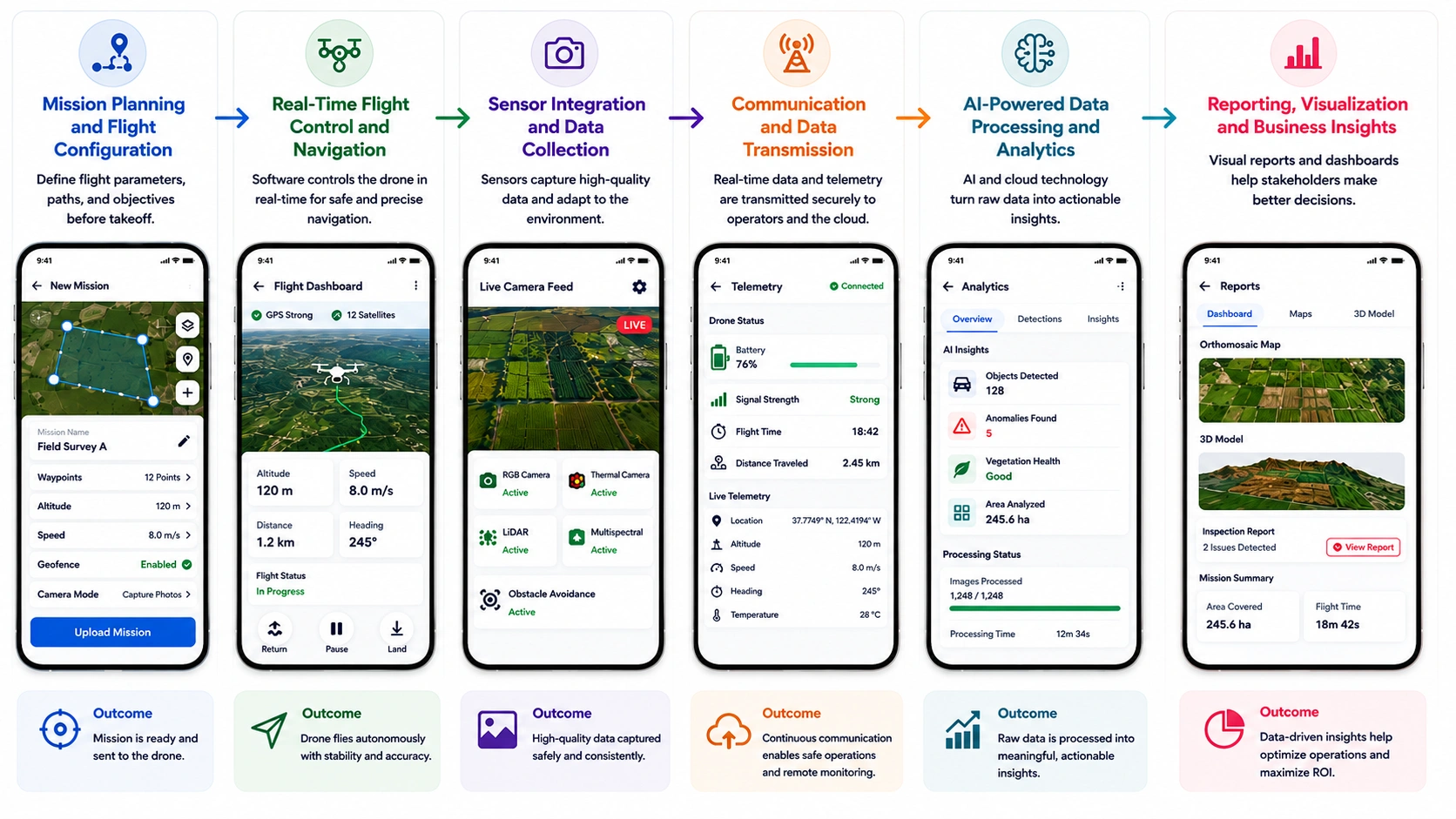
1. Mission Planning and Flight Configuration
The drone operation begins with mission planning, where operators define flight parameters through a mobile app, desktop platform, or cloud-based control system. Users can configure:
- Flight paths and waypoints that define the drone’s route and navigation points during a mission.
- Altitude and speed settings to ensure safe, efficient, and accurate flight operations.
- Geofencing boundaries that restrict the drone from entering unauthorized or restricted areas.
- Survey or inspection routes designed to systematically capture data from specific locations or assets.
- Automated mission objectives that allow the drone to perform predefined tasks with minimal manual intervention.
These instructions are then transmitted to the drone through communication networks such as Wi-Fi, radio frequency (RF), 4G/5G, or satellite connectivity, ensuring seamless mission execution.
2. Real-Time Flight Control and Navigation
During flight, the software continuously monitors and controls the drone’s movement using advanced navigation algorithms. It processes data from multiple onboard systems to maintain stability and accuracy. Key navigation technologies include:
- GPS and GNSS positioning systems help drones determine their precise location and maintain accurate navigation during flight.
- Inertial Measurement Units (IMUs) monitor movement and orientation, enabling stable and controlled flight operations.
- Accelerometers and gyroscopes measure speed, tilt, and rotational motion to keep the drone balanced and responsive.
- Compass and altitude sensors provide directional awareness and height measurements, ensuring accurate positioning and flight control.
- Autonomous waypoint navigation allows drones to follow pre-defined routes automatically, reducing manual intervention and improving mission efficiency.
This real-time coordination allows drones to follow predefined routes while adapting to environmental changes.
3. Sensor Integration and Data Collection
Modern drone software integrates with various sensors to capture operational and environmental data. The software synchronizes sensor inputs and ensures accurate data acquisition throughout the mission. Common integrated sensors include:
- High-resolution cameras capture detailed aerial images and videos for mapping, inspections, surveillance, and photography applications.
- Thermal imaging sensors detect heat signatures, making them useful for search and rescue missions, equipment inspections, and monitoring temperature variations.
- LiDAR scanners use laser pulses to create highly accurate 3D maps and terrain models, even in complex environments.
- Multispectral and hyperspectral sensors collect data across multiple light wavelengths, helping industries like agriculture and environmental monitoring analyze conditions more effectively.
- Obstacle detection and avoidance systems use sensors and real-time processing to identify obstacles and automatically adjust flight paths for safer operations.
This capability enables drones to perform aerial mapping, asset inspections, crop monitoring, surveillance, and 3D modeling with high precision.
4. Communication and Data Transmission
A critical function of drone software is maintaining continuous communication between the drone, operator, and cloud infrastructure. Real-time telemetry data is transmitted throughout the flight, providing visibility into:
- Drone location and status, including real-time position tracking and operational condition
- Battery health and performance, helping operators monitor power levels and flight readiness
- Flight speed and altitude, providing visibility into the drone’s movement and navigation metrics
- Sensor readings, such as GPS, camera, LiDAR, and environmental data collected during flight
- Mission progress updates, allowing users to track task completion and overall mission status
Reliable communication ensures safer operations, remote monitoring, and efficient fleet management.
5. AI-Powered Data Processing and Analytics
After data collection, drone software processes information using cloud computing, artificial intelligence (AI), and machine learning algorithms. These technologies transform raw aerial data into actionable business intelligence. Advanced analytics capabilities include:
- Object detection and recognition to identify vehicles, people, infrastructure, or other assets from aerial imagery.
- Anomaly and defect identification for detecting cracks, leaks, equipment faults, or other irregularities during inspections.
- Predictive maintenance insights that help businesses anticipate potential equipment failures and schedule maintenance proactively.
- Automated image classification to organize and categorize large volumes of drone-captured images with minimal manual effort.
- Route optimization and performance analysis to improve flight efficiency, reduce operational costs, and enhance mission outcomes.
AI-powered drone analytics help organizations improve operational efficiency, reduce manual effort, and accelerate decision-making.
6. Reporting, Visualization and Business Insights
Once processing is complete, the software generates reports, dashboards, maps, and visual models that stakeholders can use for analysis and planning. Typical outputs include:
- Orthomosaic maps: High-resolution aerial maps created by stitching multiple drone images together into a single accurate and georeferenced image.
- Digital elevation models (DEMs): Detailed representations of terrain elevations used for land surveying, construction planning, and environmental analysis.
- 3D terrain and infrastructure models: Three-dimensional visualizations of landscapes, buildings, and assets that support planning, inspections, and project management.
- Inspection reports: Automated reports generated from drone-collected data to identify defects, maintenance needs, and potential operational risks.
- Operational performance dashboards: Interactive dashboards that provide real-time insights into drone missions, fleet performance, and key operational metrics.
These insights enable businesses to make data-driven decisions, optimize workflows, and maximize the return on investment from their drone operations.
Drone Software Market Size and Growth Trends
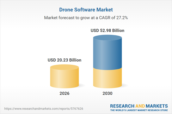
The drone software market size has grown exponentially in recent years, from $15.9 billion in 2025 to $20.23 billion in 2026 at a compound annual growth rate (CAGR) of 27.2%. This rapid growth is being driven by increasing adoption of drones across industries such as agriculture, logistics, construction, and public safety.
As unnamed aerial systems (UAVs) become vital industrial infrastructure, value is shifting from hardware to complex software integration. Driven by needs for local processing, automation, and compliance, software is now the industry’s fastest-growing segment.
According to a DroneDeploy industry report, more than 80% of enterprise drone programs use drones primarily for data collection and analysis, emphasizing the growing importance of software platforms for processing and managing aerial intelligence.
A. Rising Adoption Across Industries
Enterprises are moving past small-scale pilot programs into massive, multi-asset drone fleet operations. This industrial expansion relies entirely on specialized software architectures:
- Industrial Inspection: Energy and utility operators use sensor-enabled software to automate inspections. Drone shipments are projected to grow 2.3×, while sensor deployments grow 4×, driving demand for advanced data-processing software.
- Infrastructure Digitization: Adoption of cloud-based photogrammetry platforms is accelerating due to regulatory requirements, including the EU’s 2026 digital twin mandate for major infrastructure projects. These platforms generate accurate, compliant 3D site models.
- Precision Agriculture: Advanced multispectral imaging enables large-scale digital farming by reducing fertilizer and chemical use by 20%–30%, improving operational efficiency and farm profitability.
B. Growth of Drone Delivery Services
The drone package delivery sector has evolved from regional pilot programs into scalable commercial logistics networks. The market is projected to grow from $3.47–$4.4 billion in 2025 to $20.98–$27.4 billion by 2030–2034, at a strong 44.7% CAGR.
- E-Commerce Logistics: The largest delivery software application, representing 55% of total market value in 2026. Standard parcel delivery accounts for 48% of the segment.
- Higher-Payload Delivery: The 5–25 kg payload segment holds 37% market share in 2026, reflecting a shift from lightweight deliveries to industrial and medical cargo.
C. AI and Automation Driving Innovation
The integration of Artificial Intelligence (AI) and Machine Learning (ML) engines is completely transforming how drone software functions, moving from pilot-controlled flight toward absolute autonomy.
- On-Drone Edge AI: Edge AI chips now cost under $30 BOM, enabling real-time computer vision processing directly on drones without cloud dependence.
- BVLOS Autonomy: Regulatory progress, including the FAA’s BVLOS framework, is enabling legal autonomous Beyond Visual Line of Sight operations.
- Drone-in-a-Box (DiB): Automated docking and AI flight control enable fully autonomous inspection missions, reducing labor costs by ~70%.
Why Businesses Are Investing in Drone Software
The commercial drone industry has shifted. Early investments focused on hardware, but enterprises now view vehicles merely as sensor carriers. Advanced drone software now unlocks business value, efficiency, and ROI.
By automating flights, digitizing physical environments, and utilizing AI-driven analytics, businesses are turning raw aerial telemetry into highly actionable operational intelligence.
1. Infrastructure and Asset Inspection
Drone software automates high-risk industrial inspections by controlling flight paths and analyzing sensor telemetry. It uses computer vision to detect structural anomalies, eliminating manual hazards and reducing equipment downtime.
Industrial Impact: Duke Energy dropped energy infrastructure inspection times by 70.4% and cut operational costs by 50.3% after integrating Percepto’s automated drone software across its power plants.
2. Construction and Site Monitoring
Construction software transforms aerial photos into precise 3D digital twins and orthomosaic maps. These platforms integrate with engineering workflows to track project timelines, measure materials, and ensure design compliance.
Industrial Impact: Balfour Beatty tracks massive highway layouts using software that surveys 120 acres per hour, a 60× efficiency increase that reduces overall monitoring overhead by 20%.
3. Precision Agriculture
Agricultural software processes multispectral drone imagery to assess crop health via vegetation indices. It automates targeted spraying and field mapping, optimizing resource use and protecting thin farming margins.
Industrial Impact: John Deere ecosystem software monitors over 210 million acres of active US farmland, enabling precision agritech operators to slash chemical and fertilizer waste by 20% to 30%.
4. Mining and Surveying
Mining software converts aerial photogrammetry and LiDAR data into highly accurate 3D point clouds. It automates dangerous volumetric calculations for material stockpiles and optimizes heavy haulage road safety.
Industrial Impact: Rio Tinto maps vast concessions 4 to 10 times faster than manual ground crews by utilizing automated stockpile software that delivers centimeter-level volumetric data precision.
5. Public Safety and Emergency Response
Emergency software provides incident commanders with real-time, encrypted tactical data. It uses AI object-recognition to accelerate search-and-rescue missions and builds rapid post-disaster maps for first responders.
Industrial Impact: The FDNY leverages localized ground control interfaces during disasters, utilizing Draganfly AI software that identifies hurricane and structural damage 5× faster than traditional ground teams.
6. Logistics and Drone Delivery
Delivery software coordinates autonomous fleet routing, payload distribution, and traffic management systems. It enables beyond visual line of sight operations, transforming retail, e-commerce, and critical medical logistics.
Industrial Impact: Zipline surpassed 2 million autonomous commercial deliveries via proprietary routing software, growing US shipments 15% week-over-week with a median flight time of just 3 minutes.
Must-Have Features in Drone Software
Enterprise drone software automates aerial tasks, manages fleets, and converts flight data into insights. Integrating mission planning, AI analytics, and compliance, these platforms boost safety, scalability, and performance. The following features define the capabilities that modern drone software must deliver to support enterprise-grade UAV operations.
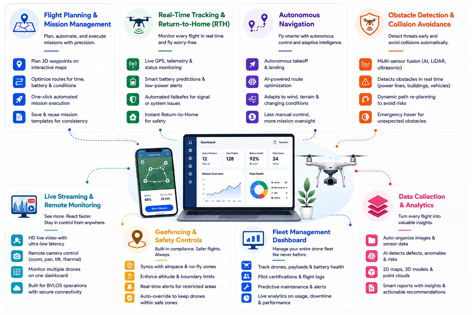
1. Flight Planning and Mission Management
Industrial drone deployment demands repeatable precision that manual piloting simply cannot deliver. This core module serves as the primary pre-flight planning desk, allowing operators to digitize three-dimensional spatial paths and automate entire mission lifecycles long before the aircraft leaves the launch pad.
- Precision Waypoint Planning: Map-based tools allow operators to define exact 3D spatial waypoints for sequential drone navigation.
- Algorithmic Route Optimization: Software analyzes terrain and weather conditions to generate the most energy-efficient flight paths.
- Automated Flight Execution: One-click launch protocols autonomously manage the entire mission, including pitch, yaw, and speed, without manual joystick control.
- Repeatable Mission Templates: Cloud-saved flight paths enable different drones to replicate identical inspection routes over time, supporting accurate longitudinal change analysis.
2. Real-Time Drone Tracking and Return-to-Home
When operating expensive equipment in commercial environments, continuous situational awareness is critical. This telemetry framework acts as an active digital lifeline, continuously streaming multi-dimensional aircraft vitals back to base and automatically triggering failsafes the millisecond anomalies occur.
- Live GPS & Telemetry Monitoring: Real-time dashboard consolidating coordinates, speed, altitude, and heading data into a single operational view.
- Predictive Battery Management: Continuously analyzes power consumption, wind resistance, and distance-to-home to determine when a drone must safely return.
- Intelligent Failsafe Monitoring: Automated safety rules detect critical issues such as control-signal loss and motor performance degradation.
- Multi-Trigger Return-to-Home (RTH): Automatically initiates return procedures, ascending to a safe altitude and navigating back to the takeoff location when triggered by low battery or system disconnection.
3. Autonomous Navigation
True scaling requires reducing the payroll and operational bottlenecks associated with dedicated, highly paid field pilots. This navigation module leverages onboard machine intelligence to handle real-time flight adjustments, shifting the human operator from an active pilot to a high-level mission supervisor.
- Autonomous Takeoff & Landing: Precision launch and recovery protocols use downward-facing sensors to enable safe departures and centimeter-level landing accuracy.
- AI Route Optimization: Real-time processing of spatial data to calculate and execute the most efficient flight paths between waypoints.
- Adaptive Flight Control: Onboard flight logic makes real-time adjustments to changing conditions such as crosswinds and thermal shifts.
- Reduced Pilot Intervention: Autonomous flight systems shift operators from manual piloting to mission-level supervision and oversight.
4. Obstacle Detection and Collision Avoidance
An enterprise drone asset must protect itself and the surrounding industrial infrastructure from physical damage. This structural module functions as an active spatial shield, processing multi-sensor inputs concurrently to construct an accurate digital model of the immediate moving environment.
- Multi-Sensor Fusion: Integrates data from computer vision cameras, LiDAR, and ultrasonic sensors into a unified spatial awareness model.
- Real-Time Obstacle Detection: Uses edge processing to identify fixed and moving obstacles, including power lines, cranes, and structures.
- Collision Avoidance Pathfinding: Dynamically recalculates flight paths to navigate around obstacles while maintaining mission continuity.
- Emergency Hover Safeguards: Triggers an immediate stable hover when obstacles emerge too quickly for safe path correction.
5. Live Video Streaming & Remote Control
For command centers managing distributed infrastructure or security teams monitoring large sites, real-time visual access is non-negotiable. This streaming hub combines high-definition video processing with low-latency communication networks to enable operations over massive distances.
- Low-Latency HD Streaming: Optimized protocols such as H.265 and WebRTC enable live aerial video with sub-second latency over cellular networks.
- Remote Camera Control: Enables stakeholders to adjust camera tilt, pan, zoom, and thermal settings from a web-based interface.
- Centralized Mission Supervision: Unified dashboards provide split-screen monitoring of multiple live drone missions from a single control center.
- BVLOS Readiness: Combines telemetry encryption, redundant network connectivity, and airspace awareness to support regulatory approval for Beyond Visual Line of Sight (BVLOS) operations.
6. Geofencing and Safety Controls
A single regulatory violation or airspace intrusion can shut down an enterprise drone program instantly. This governance engine erects permanent virtual perimeters around the aircraft, hardcoding national and local aviation mandates directly into the flight planning logic.
- Dynamic Airspace Synchronization: Continuously syncs with aviation databases, no-fly zones, and temporary flight restrictions (TFRs) to maintain airspace compliance.
- Altitude Limit Enforcement: Enforces maximum altitude restrictions to prevent entry into regulated airspace and commercial flight corridors.
- Automated Safety Alerts: Generates real-time warnings when drones approach restricted, controlled, or military airspace boundaries.
- Flight Path Overrides: Autopilot safeguards automatically override pilot inputs to keep drones clear of restricted airspace, even under adverse conditions such as strong winds.
7. Fleet Management Dashboard
As a drone program grows from a single unit into hundreds of active multi-regional assets, tracking logistics via spreadsheets becomes impossible. This dashboard functions as an enterprise ERP platform built specifically for the commercial aviation ecosystem.
- Fleet Asset Management: Tracks the location, utilization, and lifecycle status of aircraft, payloads, and battery assets.
- Pilot & Crew Compliance: Manages pilot certifications, compliance records, and flight logs, while assigning qualified personnel to missions.
- Predictive Maintenance: Analyzes flight telemetry and usage hours to detect component wear and automatically generate maintenance workflows.
- Operational Analytics: Consolidates asset utilization, downtime, and mission success metrics into business intelligence dashboards.
8. Data Collection and Analytics
The true business value of a commercial drone program is not the flight itself, but the data captured. This ingestion and processing engine cleanses raw aerial telemetry and transforms unstructured images into actionable asset management insights.
- Automated Data Ingestion: Organizes high-resolution, geotagged imagery and sensor data into asset-linked repositories.
- AI Anomaly Detection: Uses computer vision to identify structural defects, thermal anomalies, corrosion, and vegetation encroachment.
- Photogrammetry & 3D Mapping: Converts overlapping aerial imagery into orthomosaics, digital elevation models (DEMs), and 3D point clouds.
- Inspection Reporting & Insights: Generates engineering reports with prioritized findings, repair recommendations, and risk assessments.
AI-Powered Capabilities in Modern Drone Software
AI-powered drone software transforms UAVs into intelligent, autonomous systems capable of real-time decision-making and advanced data analysis. By leveraging machine learning and edge computing, these platforms improve operational efficiency, enable predictive insights, automate complex tasks, and support scalable multi-drone operations across industries.
1. Computer Vision and Object Detection
Raw aerial video data is functionally useless without continuous, real-time context interpretation. This computer vision layer serves as the drone’s visual cortex, running deep learning model networks to automatically identify, categorize, and track physical assets on the ground directly from the live video feed.
- Edge-Optimized CNN Processing: Deploys lightweight convolutional neural networks (CNNs) onboard to analyze high-resolution imagery in real time.
- Multi-Class Object Detection: Automatically identifies and segments vehicles, personnel, equipment, and infrastructure assets.
- Real-Time Object Tracking: Uses dynamic bounding boxes to track object locations and movement across consecutive frames.
- Low-Visibility Detection: Combines infrared and thermal imaging to maintain object identification in low-light, nighttime, and adverse weather conditions.
2. Intelligent Mission Adaptation
Static flight paths fail when confronted with unpredictable real-world field conditions. This module leverages real-time edge processing to give the drone situational decision-making autonomy, allowing the aircraft to alter its own flight behaviors dynamically based on immediate environmental feedback.
- Dynamic Path Recalculation: Autonomously reroutes around static and moving obstacles while maintaining mission objectives.
- Adaptive Weather Response: Uses wind and pressure telemetry to adjust flight parameters and maintain safe operations in changing weather conditions.
- Dynamic Mission Prioritization: Enables drones to modify routes in real time based on newly detected events or operational priorities.
- Flight Boundary Recovery: Continuously validates position data and automatically returns aircraft to safe flight paths when approaching geofence limits.
3. Predictive Maintenance
Unplanned hardware failure in the field can result in catastrophic asset losses and severe regulatory liabilities. This proactive analytics module monitors the drone’s internal physical health variables continuously, using machine learning to predict mechanical and electrical degradation weeks before a structural breakdown occurs.
- Telemetry Anomaly Detection: Monitors voltage patterns, motor performance, and sensor calibration drift to identify deviations from normal operating conditions.
- Thermal Health Monitoring: Tracks battery and onboard computing temperatures to detect overheating risks before component failure.
- Structural Fatigue Analysis: Analyzes acoustic and vibration data to identify propeller wear, blade cracks, and motor mount degradation.
- Automated Maintenance Workflows: Automatically generates maintenance actions and grounds aircraft when health metrics fall below safety thresholds.
4. AI-Powered Inspection and Anomaly Detection
Traditional industrial inspections require field teams to manually review thousands of high-resolution aerial photos. This core automation framework uses trained computer vision models to ingest mass visual data, instantly flagging structural defects and agricultural anomalies with extreme precision.
- ML Defect Detection: Uses custom vision models to identify cracks, corrosion, and structural degradation across large photogrammetry datasets.
- Multi-Spectral Analytics: Processes multi-spectral imagery to calculate vegetation indices and detect crop stress and irrigation issues before they become visible.
- Automated Risk Triage: Routes detected anomalies into centralized dashboards, enabling teams to prioritize high-risk findings without manual review.
- Unstructured Data Transformation: Converts large volumes of aerial imagery into actionable engineering reports, accelerating analysis and decision-making.
5. Predictive Mission Planning
Maximizing the return on investment of an enterprise drone fleet requires stripping away operational guesswork. This predictive planning engine parses massive historical performance data blocks to automatically schedule and structure flight profiles for maximum accuracy and zero wasted resource hours.
- Weather-Based Mission Planning: Analyzes historical weather data to identify optimal launch windows and avoid adverse flight conditions.
- Fleet Resource Allocation: Automatically assigns drone platforms and sensor payloads based on mission requirements, terrain, and site coverage needs.
- Battery Lifecycle Optimization: Manages battery rotation and utilization to extend asset lifespan and maintain balanced fleet usage.
- Predictive Energy Modeling: Simulates flight paths to forecast battery consumption and mission endurance before deployment.
Drone Software Development Process
The commercial drone software development requires aligning custom software code with complex aviation hardware. We systematically transform multi-sensor payloads and autonomous flight controllers into a unified digital infrastructure, ensuring absolute operational control, bulletproof data security, and seamless enterprise scalability.
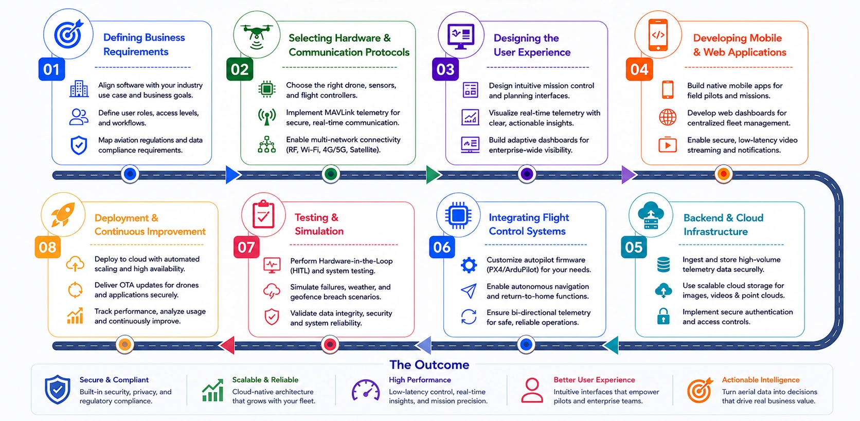
1. Defining Business Requirements
Our strategic business architects deconstruct your commercial vision into rigid technical boundaries. We isolate your exact vertical industry use case, catalog multi-tier enterprise personnel access parameters, and chart specialized data collection workflows to ensure software functionality perfectly matches your underlying ROI goals.
- Target Industry and Use Case Alignment: Tailoring the software framework to fulfill specific industrial mandates, whether managing automated agricultural mapping, utility grid inspections, or high-security site surveillance.
- Multi-Tier User Role Profiling: Structuring discrete, isolated permissions and views for field deployment pilots, compliance reviewers, and executive data analysts.
- Aviation Regulatory Compliance Mapping: Hardcoding localized flight tracking rules, altitude constraints, and data retention mandates into your foundational product specifications.
2. Selecting Drone Hardware and Communication Protocols
We identify drone hardware such as airframes, flight controllers, cameras, LiDAR, and sensors and integrate them with the software via telemetry and communication channels. Using MAVLink over RF, cellular, or satellite networks, we enable reliable real-time control, monitoring, and data transmission.
- Payload and Flight Controller Pairing: Matching custom applications with industrial airframes, Pixhawk or DJI flight controllers, and scientific sensors like LiDAR and thermal optics.
- Low-Latency Telemetry Protocol Architecture: Implementing lightweight MAVLink communication standards to manage secure, bi-directional data flow between the drone and the ground station.
- Multi-Network Connectivity Routing: Engineering the software to smoothly transition control paths across RF, Wi-Fi, 4G/5G, and satellite nodes based on real-time signal strength.
3. Designing the User Experience
Our UX design division wireframes a high-fidelity, single-thumb-optimized operator canvas. We map out clean flight planning views, low-latency live streaming frames, and unified administrative control centers that minimize cognitive burden and prevent high-stress field errors.
- Ergonomic Mission Control Layouts: Creating clean, clutter-free interfaces that allow field pilots to plan complex multi-point flights with minimal taps.
- Real-Time Telemetry Visualization: Designing intuitive Heads-Up Displays (HUDs) that surface critical flight speeds, battery depletion limits, and GPS strengths cleanly.
- Adaptive Enterprise Dashboards: Constructing responsive, cross-platform web layout frameworks tailored for fleet administrators managing multi-drone commercial arrays.
4. Developing Mobile and Web Applications
Our software developers construct high-performance native mobile apps and centralized web terminals from scratch. We build robust ground control stations (GCS) featuring automated flight triggers, encrypted video pipelines, context-aware notification engines, and fluid multi-device account syncs.
- Native Ground Control Programming: Developing high-efficiency iOS and Android mobile software optimized for field execution and zero-lag hardware command response.
- Centralized Fleet Oversight Terminals: Coding responsive web dashboards that aggregate distributed geographical drone insights, user logs, and live camera streams concurrently.
- Low-Latency Stream Ingestion: Building specialized multimedia pipelines to display high-definition aerial footage over cellular data networks seamlessly.
5. Backend and Cloud Infrastructure Development
We build a highly scalable, zero-trust cloud backend to manage massive telemetry streams securely. Our developers deploy optimized data warehousing nodes, automated user authentication checkpoints, and high-throughput parsing pipelines to process gigabytes of aerial data without lag.
- High-Throughput Telemetry Ingestion: Structuring specialized databases capable of parsing and storing parallel data points from thousands of active aircraft.
- Distributed Cloud Asset Storage: Configuring secure, optimized storage buckets to handle heavy unstructured aerial image assets, LiDAR point clouds, and video logs.
- Secure Enterprise Authentication: Hardcoding strict multi-factor authentication and encrypted token pathways to block unauthorized corporate access to flight profiles.
6. Integrating Flight Control Systems
Our specialized embedded engineers bridge your digital software with actual physical aviation electronics. We integrate and customize open-source autopilot stacks like PX4 and ArduPilot, enabling autonomous waypoint navigation, millisecond-level command execution, and flawless sensor communication loops.
- Autopilot Firmware Customization: Tailoring underlying PX4 or ArduPilot source code to handle proprietary flight maneuvers, custom payloads, and strict speed constraints.
- Autonomous Navigation Syncing: Linking ground control commands directly to the drone’s internal processing unit for independent waypoint tracing and automated return-to-home overrides.
- Bi-Directional Telemetry Handshakes: Engineering continuous validation loops that cross-check sent drone commands against actual physical sensor outputs to prevent flight divergence.
7. Testing and Simulation
Our quality assurance department subjects your platform to an intense array of virtual and physical stress scenarios. We execute Hardware-in-the-Loop (HITL) testing, simulate severe weather interruptions, run automated penetration scans, and calibrate data telemetry to ensure absolute airspace safety.
- Hardware-in-the-Loop (HITL) Testing: Running your custom software on live flight computer hardware connected to a simulated physics environment to safely validate autopilot code.
- Failure Scenario Flight Simulations: Testing system responses against sudden motor failures, complete sensor signal disconnects, and aggressive geofence boundary breaches.
- Interoperability and Data Validation Auditing: Reviewing database integrity under high simulated stress to guarantee zero packet drops during high-volume enterprise operations.
8. Deployment and Continuous Improvement
Our DevSecOps engineers manage clean cloud release frameworks to scale your product safely nationwide. We monitor active server resource constraints, deploy automated over-the-air (OTA) firmware patches, collect user behavioral telemetry, and execute rolling updates to maximize application uptime.
- Continuous Cloud Scale Orchestration: Setting up automated server clusters to seamlessly expand operational processing power as your active commercial drone fleet grows.
- Over-the-Air (OTA) Firmware Deployments: Engineering secure wireless delivery mechanisms to safely update aircraft flight parameters and ground control apps simultaneously.
- Performance Metric Event Tracking: Monitoring crash analytics and active feature usage to uncover system bottlenecks, guiding targeted future feature upgrades.
How Much Does It Cost to Develop Drone Software?
The cost of drone software development varies significantly based on the platform’s complexity, autonomy level, hardware integrations, AI capabilities, compliance requirements, and scalability goals. A basic mission management application costs considerably less than an enterprise-grade platform supporting fleet management, real-time analytics, and autonomous operations.
To better understand where your investment goes, the following table breaks down estimated costs across each stage of the drone software development lifecycle.
| Development Phase | Estimated Cost (MVP → Enterprise) | What the Phase Covers |
| Discovery & Requirement Analysis | $2,000 – $15,000 | Business goals, use case validation, workflow mapping, technical feasibility assessment, and project planning. |
| UI/UX Design | $3,000 – $25,000 | User journeys, wireframes, dashboards, mission planning interfaces, and responsive application designs. |
| Mobile & Web Application Development | $10,000 – $100,000 | Mission control features, live monitoring, user management, notifications, and operational dashboards. |
| Backend & Cloud Infrastructure | $8,000 – $80,000 | APIs, databases, telemetry processing, authentication systems, cloud storage, and scalability architecture. |
| Flight Control System Integration | $5,000 – $70,000 | Drone communication, MAVLink integration, sensor connectivity, telemetry synchronization, and command execution. |
| AI & Analytics Development | $0 – $120,000 | Computer vision, object detection, predictive analytics, route optimization, and automated inspections. |
| Testing & Simulation | $4,000 – $40,000 | Flight simulations, performance testing, hardware validation, security assessments, and compliance verification. |
| Deployment & Maintenance | $3,000 – $50,000+ | Cloud deployment, monitoring, performance optimization, updates, and ongoing technical support. |
| Total Estimated Cost | $40,000 – $500,000+ | Combined cost across all development phases. |
Note: The minimum end of each range reflects a typical MVP drone software solution, while the higher end represents enterprise-grade platforms with advanced automation, AI capabilities, large-scale fleet management, and extensive integrations. Actual costs of drone software development may vary based on regulatory requirements, drone hardware compatibility, third-party integrations, and project complexity.
A. Why Does AI & Analytics Development Range from $0 to $120,000?
AI and analytics development has a broad cost range because these features are not always mandatory. Many MVP drone platforms prioritize core flight planning and fleet management, enabling launches without initial AI investment.
At the lower end, the costs can be $0 for platforms using only standard drone operations and reporting features. However, adding intelligent automation and data-driven insights makes AI development a major project expense.
The cost can increase significantly when implementing features such as:
- Computer Vision: Object detection, image classification, defect identification, and visual inspections.
- Predictive Analytics: Maintenance forecasting, battery health monitoring, and operational risk prediction.
- Autonomous Navigation: AI-assisted route planning, obstacle avoidance, and mission optimization.
- Real-Time Video Analysis: Processing live drone feeds for surveillance, security, or industrial monitoring.
- Custom Machine Learning Models: Training AI systems using industry-specific datasets for agriculture, construction, energy, mining, or logistics applications.
Enterprise platforms requiring large datasets, cloud AI, and continuous optimization for accuracy often reach the $120,000 cost limit, particularly when advanced automation and computer vision are vital.
B. Development Cost by Drone Software Type
The overall project budget depends heavily on the type of drone software being developed, the industry use case, the level of automation required, and the complexity of integrations involved.
| Software Type | Estimated Cost | Key Features Included |
| Basic Drone App | $40,000 – $70,000 | Flight planning, waypoint navigation, live drone tracking, telemetry monitoring, mission management, user authentication, and basic reporting dashboards. |
| Inspection Platform | $80,000 – $150,000 | Automated inspection workflows, image and video capture, defect reporting, asset monitoring, cloud storage, GIS integration, and inspection analytics. |
| Fleet Management Software | $100,000 – $250,000 | Multi-drone management, fleet tracking, maintenance scheduling, pilot management, mission history, geofencing, compliance monitoring, and operational dashboards. |
| AI-Powered Enterprise Platform | $200,000 – $500,000+ | Computer vision, object detection, predictive maintenance, autonomous navigation, real-time video analytics, advanced reporting, enterprise integrations, and large-scale fleet operations. |
Note: Costs can vary significantly depending on features such as real-time telemetry, AI-powered analytics, computer vision, autonomous navigation, cloud infrastructure, regulatory compliance requirements, and integrations with third-party systems such as GIS, ERP, IoT, or asset management platforms.
C. Factors That Influence Development Budget
Several technical and business considerations directly impact the final cost of drone software development.
- Platform Complexity: Autonomous operations, fleet management, real-time analytics, and advanced workflows can increase development costs 2–5×, raising budgets from $25K–$60K for basic applications to $200K+ for enterprise platforms.
- AI & Computer Vision: Object detection, anomaly recognition, predictive maintenance, and intelligent automation can add $10K–$100K+, depending on training data requirements and model accuracy.
- Hardware & Sensor Integration: Support for LiDAR, thermal, multispectral, GPS, and custom payloads typically adds $5K–$50K in integration and testing costs.
- Cloud Infrastructure: Real-time telemetry, video streaming, and large-scale data storage can drive cloud costs of $500–$5K+ per month, depending on usage and scalability requirements.
- Regulatory Compliance: Remote ID, BVLOS readiness, security controls, and aviation compliance can add 10–20% to project budgets through certification, testing, and documentation.
Drone Software Technology Stack Recommendation
A robust drone software development requires multiple technologies working together across flight control, application development, cloud infrastructure, AI processing, and geospatial analytics. The table below outlines the key components commonly used in modern drone software development.
| Technology Layer | Purpose | Common Technologies |
| Flight Control Frameworks | Enable drone navigation, autonomous flight, telemetry exchange, mission execution, and hardware communication. | PX4, ArduPilot, DJI SDK, MAVSDK, DroneKit |
| Ground Control Software | Provide mission planning, drone monitoring, flight management, and telemetry visualization. | QGroundControl, Mission Planner, UgCS, MAVProxy |
| Mobile Development Technologies | Build operator-facing mobile applications for mission control, tracking, and live monitoring. | Flutter, React Native, Swift (iOS), Kotlin (Android) |
| Backend Development Technologies | Handle APIs, user management, telemetry processing, data storage, and business logic. | Node.js, Python, Java, Go, .NET |
| Cloud Infrastructure and Storage | Support real-time communication, scalable processing, data storage, and fleet management. | AWS, Microsoft Azure, Google Cloud Platform, Firebase |
| AI and Machine Learning Frameworks | Power object detection, route optimization, anomaly detection, predictive analytics, and computer vision. | TensorFlow, PyTorch, OpenCV, Scikit-learn |
| Mapping and Geospatial Technologies | Process aerial imagery, generate maps, create 3D models, and perform spatial analysis. | ArcGIS, QGIS, Mapbox, CesiumJS, PostGIS |
| Databases and Data Management | Store telemetry data, mission logs, user information, and operational records. | PostgreSQL, MongoDB, MySQL, TimescaleDB |
| Communication Protocols | Facilitate data exchange between drones, ground stations, and cloud systems. | MAVLink, MQTT, WebSockets, RTSP, HTTP/HTTPS |
| Simulation and Testing Tools | Test drone behavior, autonomous navigation, and flight scenarios before deployment. | Gazebo, AirSim, SITL, HITL, Unreal Engine |
Note: The specific technology stack varies by use case, including surveying, agriculture, or delivery. Enterprise platforms frequently integrate diverse technologies to enable scalability, AI analytics, real-time processing, and secure management.
Top Drone Software Examples
The drone software market offers solutions for mapping, inspections, fleet management, autonomous flight, and analytics. Analyzing leading platforms reveals the features driving adoption and key innovation opportunities.
Below are five notable drone software solutions that have established strong positions across different segments of the industry.
1. DroneDeploy
DroneDeploy is one of the most widely adopted drone software platforms for aerial mapping, construction monitoring, and asset inspections. The platform enables businesses to automate drone missions, capture aerial imagery, and convert collected data into actionable insights through cloud-based analytics.
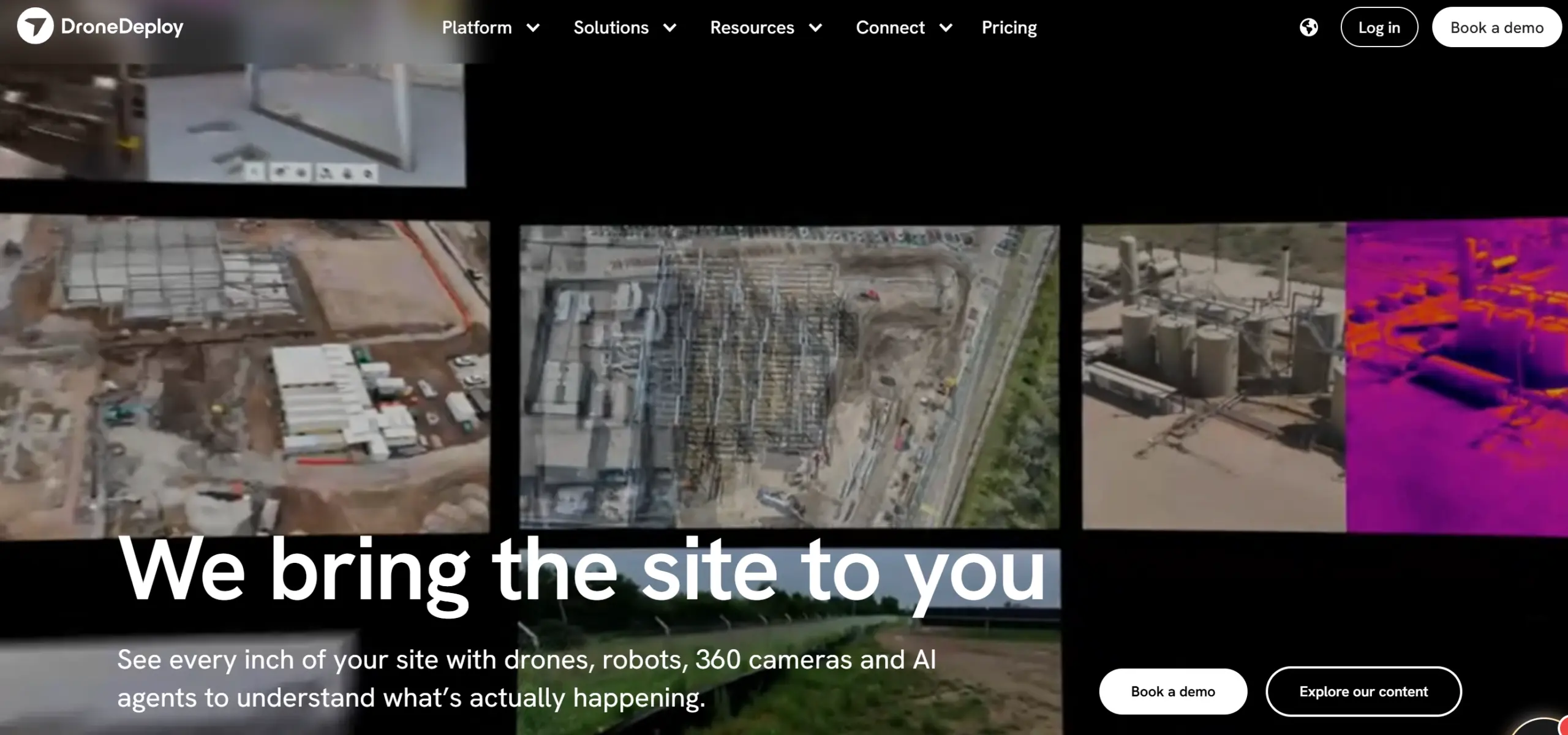
- Core Capabilities: Supports orthomosaic mapping, progress tracking, 3D modeling, and inspection workflows.
- Key Industries: Widely used across construction, agriculture, energy, and infrastructure sectors.
- Business Value: Combines automated flight planning with advanced analytics to transform aerial data into actionable operational intelligence.
2. Pix4D
Pix4D is a leading photogrammetry and mapping platform that specializes in converting drone imagery into highly accurate 2D maps, 3D models, and digital twins. The software is widely used across surveying, mining, construction, agriculture, and environmental monitoring projects.
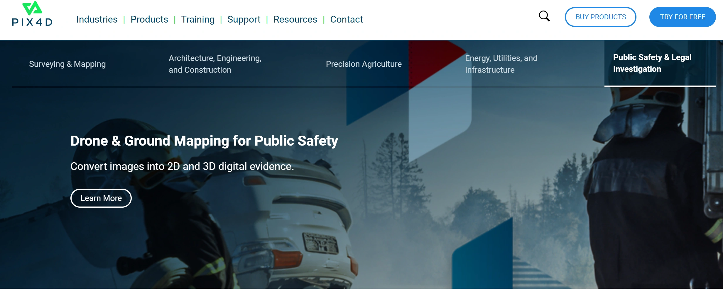
- Advanced Processing: Converts large volumes of drone imagery into precise geospatial outputs.
- Visualization Tools: Generates detailed maps, models, and digital twins for analysis and planning.
- Business Value: Helps organizations improve decision-making through accurate data processing and visualization capabilities.
3. Drone Harmony
Drone Harmony specializes in intelligent mission planning and automated inspection workflows for complex environments. The platform allows operators to create terrain-aware flight plans and automate inspections of infrastructure, industrial assets, and construction sites.
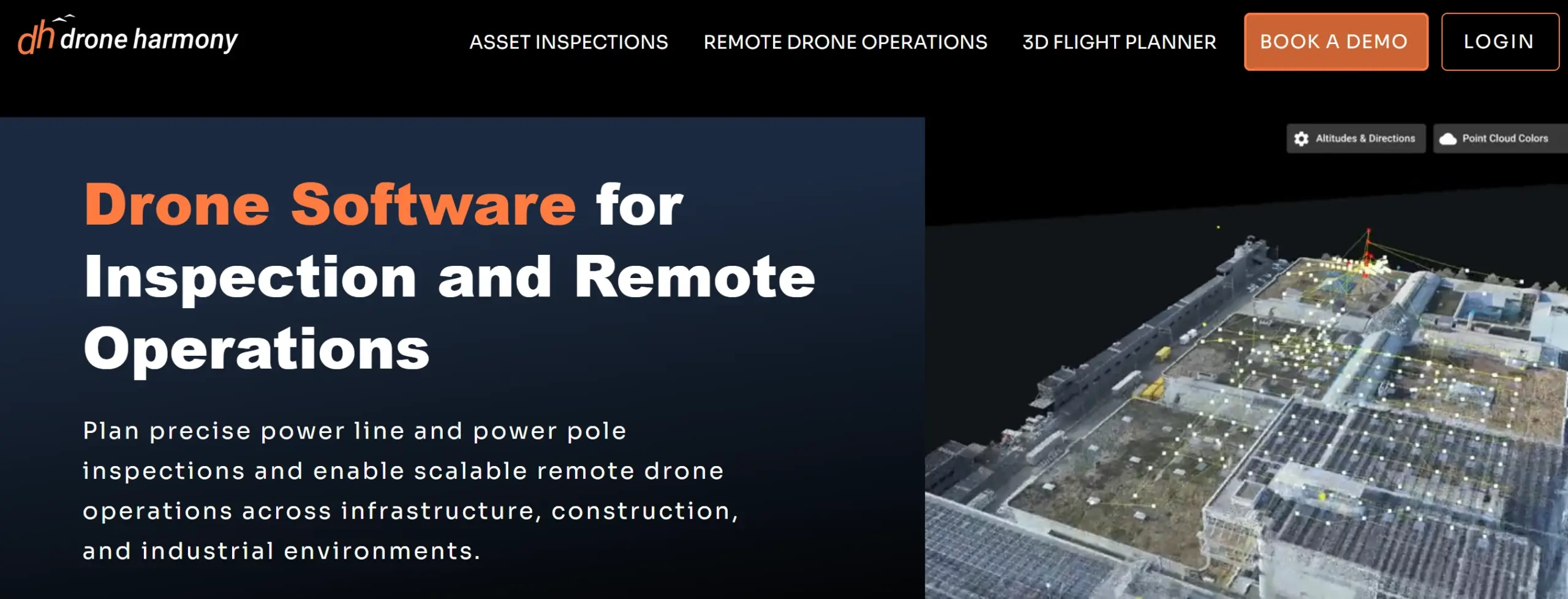
- Core Capabilities: Supports automated flight planning, terrain-aware missions, 3D inspection modeling, and infrastructure inspection workflows.
- Key Industries: Widely adopted across utilities, telecommunications, mining, construction, and infrastructure management.
- Business Value: Reduces pilot workload while improving inspection consistency, operational efficiency, and data collection accuracy.
4. AirData UAV
AirData UAV is a comprehensive drone fleet management and analytics platform designed to help organizations monitor drone performance, improve operational efficiency, and maintain compliance. The software collects and analyzes flight logs, battery performance data, pilot activity, and maintenance records.
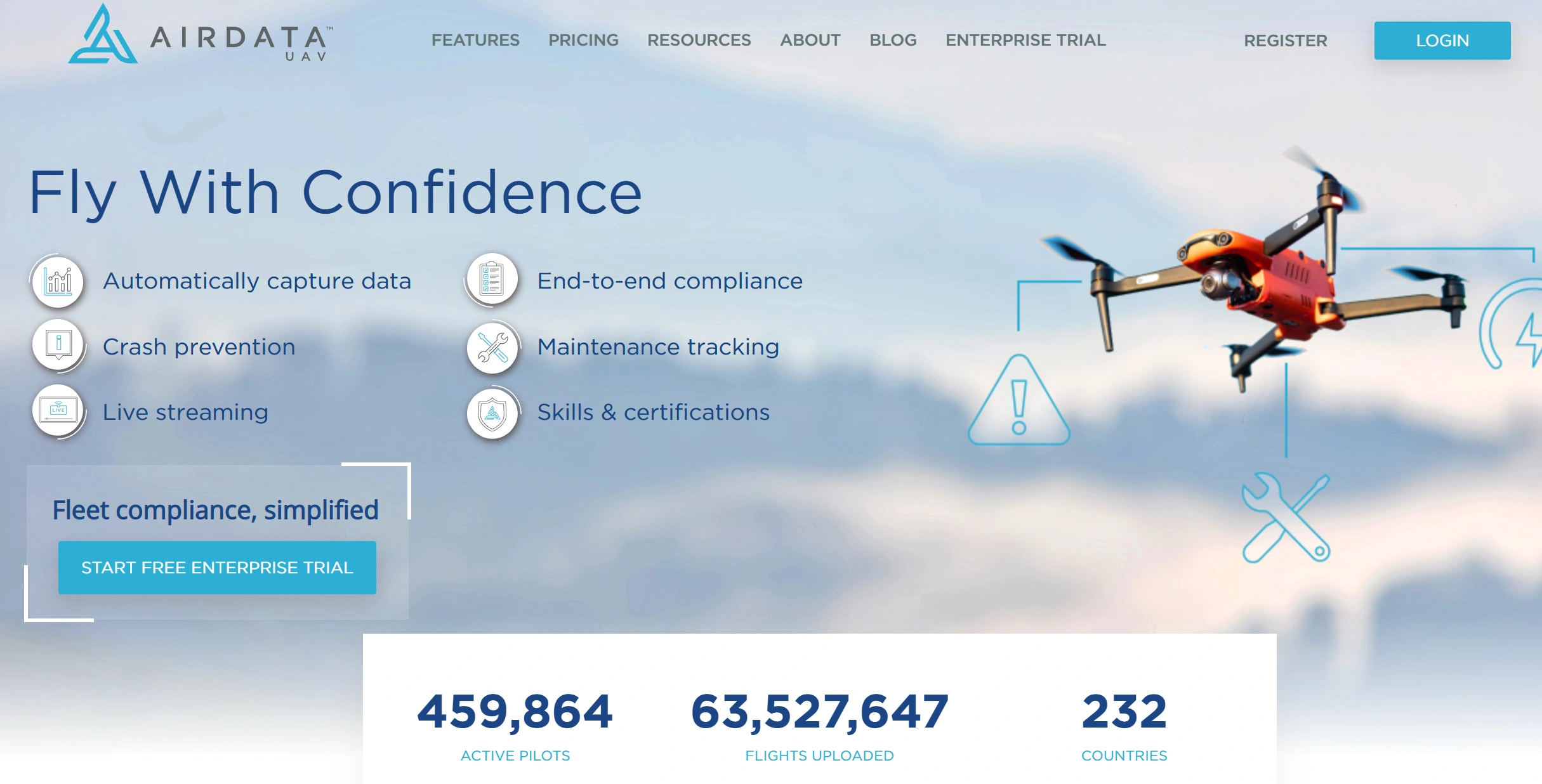
- Fleet Monitoring: Tracks drone health, pilot activity, and operational performance.
- Analytics & Compliance: Provides insights into maintenance requirements and regulatory compliance.
- Business Value: Helps organizations optimize fleet operations while ensuring safe and reliable drone usage.
5. FlytBase
FlytBase is an enterprise-focused drone automation platform that enables organizations to build autonomous drone operations at scale. The platform is particularly known for supporting drone-in-a-box solutions, remote inspections, security monitoring, and industrial automation workflows.
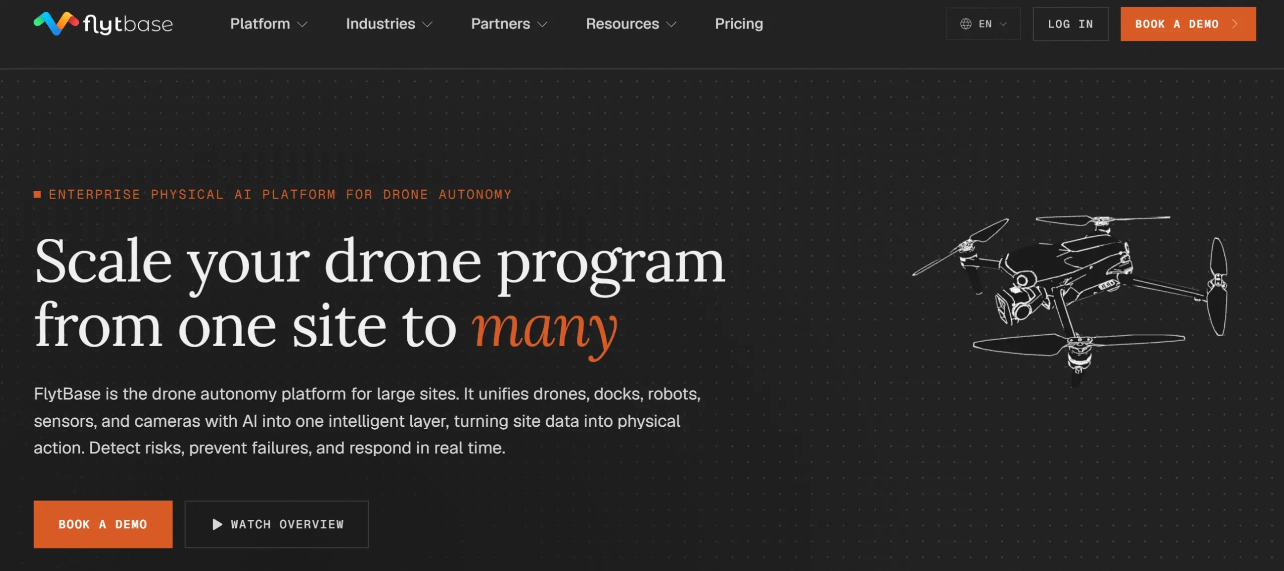
- Enterprise Automation: Supports autonomous mission execution and large-scale drone deployments.
- Integration Capabilities: Offers remote fleet management, cloud-based controls, and third-party integrations.
- Business Value: Enables organizations to integrate drone operations into broader enterprise workflows for continuous, data-driven monitoring and inspections.
Future Trends in Drone Softwares
The evolution of commercial drones hinges entirely on next-generation software architectures. As hardware platforms stabilize, the primary competitive battlefield has shifted toward advanced algorithmic development, intent-driven automation, and ultra-secure communication protocols that redefine what unmanned aircraft can achieve.
1. AI Autonomy
AI flight software evolves drones into fully cognitive, self-deciding assets. Neural networks process environmental data natively to manage obstacle avoidance, path optimization, and inspections without GPS or human input.
Industrial Impact: Skydio deployed its Autonomy software engine across enterprise fleets, enabling drones to autonomously map complex industrial environments and identify structural anomalies 5× faster than human-piloted operations.
2. Swarm Intelligence
Swarm software leverages decentralized ad-hoc mesh networking to enable multiple drones to communicate and collaborate as a single, unified entity. If an individual drone suffers a hardware failure, the remaining swarm automatically reorganizes and reallocates operational tasks to ensure complete mission success.
Industrial Impact: Auterion launched its Nemyx swarm orchestration engine, allowing public safety operators to deploy multi-manufacturer drone fleets that coordinate complex search-and-rescue grids completely free of human collision risks.
3. Digital Twins
Advanced photogrammetry and cloud analytics software continuously sync physical assets with high-fidelity digital replicas. By streaming automated drone imagery into cloud engines, enterprise teams can instantly run predictive stress-testing models, simulate operational adjustments, and maintain highly accurate structural records.
Industrial Impact: Bentley Systems integrated high-density drone photogrammetry software to maintain digital twins of major European rail networks, reducing manual surveying labor costs by over 40%.
4. Edge Computing
Onboard edge-processing architectures eliminate traditional cloud latency bottlenecks by analyzing heavy sensor payloads natively during active flight. Drones equipped with Edge-AI chips can process computer-vision algorithms instantly, triggering automated emergency alerts the moment a defect or threat is visually detected.
Industrial Impact: Percepto deployed Edge-AI software across chemical production plants, allowing autonomous docking drones to instantly isolate gas leaks natively on-site, trimming emergency response windows down to under 60 seconds.
5. BVLOS Operations
Beyond Visual Line of Sight (BVLOS) software structures provide the regulatory and technical frameworks required for long-range, automated operations. These software stacks integrate real-time Unmanned Traffic Management (UTM) protocols, weather feeds, and encrypted cellular command links to safely pilot drones across hundreds of miles.
Industrial Impact: Following Canada’s landmark 2025/2026 BVLOS framework expansion, logistics operators utilized advanced command-and-control software links to safely scale regional medical cargo delivery flight hours by 35.7%.
Partner With IdeaUsher for Your Drone Software Development
IdeaUsher is a premier global technology solutions powerhouse with 11+ years of experience engineering sophisticated software architectures across 50+ countries. Driven by 250+ niche technical experts, a portfolio of 1,000+ completed projects, and a 4.9/5 Clutch rating, we excel at building advanced UAV ecosystems.
By integrating custom autopilot firmware with real-time MAVLink telemetry, edge AI vision, and secure cloud pipelines, we provide enterprise-grade software built for autonomous industrial tasks and efficient fleet scaling.
Why Enterprises Partner With Us
Global industrial innovators and UAV flight networks choose IdeaUsher because we smoothly bridge complex aviation electronics with scalable, cloud-native enterprise software infrastructure.
- Custom Autopilot Integration Expertises: We possess deep engineering capabilities customizing open-source autopilot stacks like PX4 and ArduPilot to execute precise waypoint navigation and autonomous flight routines.
- Edge-Optimized AI Computer Vision: Our teams build and deploy specialized neural networks directly onto drone hardware for real-time object classification, tracking, and structural anomaly detection.
- High-Throughput Spatial Telemetry Data Sync: We build secure, low-latency communication bridges that stream real-time coordinate variables and process heavy geospatial datasets across 4G/5G and satellite networks.
- Bulletproof Fleet Security Governance: We eliminate corporate liability risk by hardcoding robust access controls, advanced end-to-end data encryption, and unalterable chronological system auditing logs into the platform fabric.
Ready to transform your UAV fleet into a completely autonomous, data-driven enterprise asset? Contact our experienced ex-FAANG/MAANG software developers at Idea Usher to engineer your custom flight infrastructure strategy today.
Conclusion
Drone software has become the foundation of modern UAV operations, enabling businesses to automate missions, collect aerial data, and manage drone fleets efficiently. From construction monitoring and infrastructure inspections to agriculture and delivery services, organizations are increasingly relying on software-driven drone ecosystems. As demand for autonomous operations and AI-powered analytics grows, a robust drone software development is becoming a strategic investment. This guide explores drone software development, key features, technology stacks, costs, and leading industry examples.
Things to Know
Q.1. What features are essential in drone software?
A.1. Modern drone software typically includes flight planning, real time tracking, autonomous navigation, fleet management, data analytics, and geofencing capabilities. These features help improve operational efficiency, safety, and decision making across industries.
Q.2. How much does drone software development cost?
A.2. Drone software development typically costs between $25,000 and $60,000 for a basic application with flight planning and tracking features. More advanced platforms with fleet management, AI capabilities, autonomous operations, and enterprise integrations can range from $150,000 to $500,000+, depending on complexity and scalability requirements.
Q.3. Which industries benefit most from drone software?
A.3. Industries such as construction, agriculture, energy, mining, logistics, and infrastructure management benefit significantly from drone software. These platforms help automate operations, collect aerial data, improve safety, and reduce operational costs.
Q.4. Why is AI important in drone software development?
A.4. AI enables drones to perform advanced functions such as object detection, predictive maintenance, route optimization, and automated inspections. These capabilities improve accuracy, reduce manual effort, and enhance operational efficiency.